Montezuma Well
AtoZ Places Bucket Location


Abandoned & Ghost Towns

Ancient Ruins

Caves

Desert

Forest

Historical

Hot Springs

Lakes & Rivers

National & State Parks

Peaks


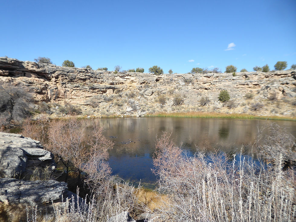


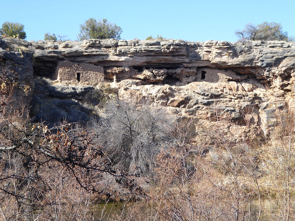


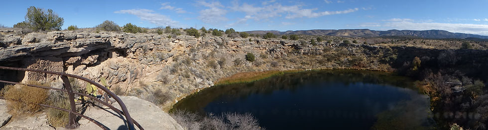
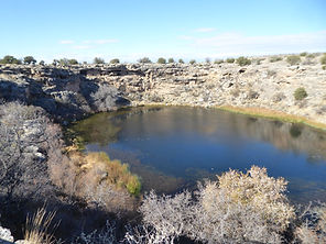


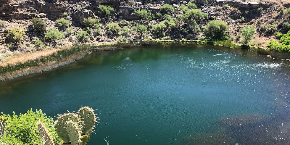
Montezuma Well near Rimrock, Arizona is one of the most quietly astonishing natural features in the American Southwest — a 368-foot-wide, 55-foot-deep limestone sinkhole discharging 1.5 million gallons of spring water daily, home to five species found nowhere else on Earth, surrounded by 900-year-old Sinagua cliff dwellings and an irrigation canal still carrying water today.
National & State Parks
Ancient Ruins

Wildlife

Exploring

Hiking
America the Beautiful pass accepted for day use
Arizona State Parks pass accepted

Dogs should remain on leash
No camping — day use only
Picnic area with tables
Restrooms available
Water: Bring your own — no water on trails
More Info
Plants Foraged
Nearby Locations
Tuzigoot National Monument

Dead Horse Ranch State Park

Palatki Heritage Site

Montezuma Well
Eleven miles northeast of Montezuma Castle, tucked into the limestone hills above Beaver Creek near the small community of Rimrock, is one of the most quietly astonishing natural features in the American Southwest. You don't see it until you're almost on top of it — a nearly circular depression in the earth, 368 feet across and 55 feet deep, filled with water that has been flowing here continuously for thousands of years.
Montezuma Well is not a lake. It's not a reservoir. It's a sinkhole — formed when a limestone cave collapsed to expose its subterranean water source — similar in origin to the cenotes of the Yucatan Peninsula and the sinkholes of Florida. Two underground springs feed it, discharging approximately 1.5 million gallons of water per day at a constant temperature of 74°F regardless of drought, rainfall, or season. The water has been flowing at this rate since before the Sinagua arrived. It will be flowing long after we're gone.
We visited twice — December 14, 2020 and May 20, 2022. Both visits were combined with Montezuma Castle using the same entrance fee that covers both units of the monument.
The Water — Not What It Appears
Looking into the Well the water appears impossibly clear and inviting. It is not suitable for drinking. The water is highly carbonated — saturated with carbon dioxide from the volcanic geology of the Verde Valley — and contains elevated levels of arsenic. Swimming and wading are prohibited. The carbon dioxide concentration is high enough that fish cannot survive in the Well itself — no fish species live in its waters, which is part of what makes the ecosystem so unusual.
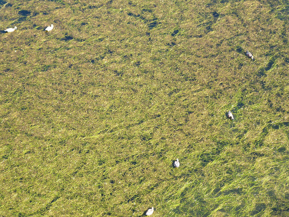
What does live in the Well is extraordinary. At least five endemic species have evolved here — organisms found nowhere else on Earth: a diatom, a springtail, a water scorpion, an amphipod, and a leech. The Montezuma Well springsnail also inhabits the spring outflow. These species evolved in biological isolation over thousands of years in this specific body of water. The Well is one of the most endemic spring ecosystems in the American Southwest.
The Geology — 3 Million Years in the Making
About 3 million years ago, a volcanic eruption from Squall Peak southwest of Camp Verde poured lava down the mountainside and blocked the canyon through which the ancient Verde River flowed. The water backed up into lakes that covered the Verde Valley floor. The limestone that forms the bedrock of this area was deposited beneath those ancient lakes between 2 and 8 million years ago — the same Verde Limestone formation visible in the travertine formations at Fossil Creek. When the cave beneath the limestone collapsed it exposed the subterranean spring system, creating the Well.
The Sinagua Connection — Ancient Infrastructure Still in Use
The presence of reliable water in an arid desert landscape did what reliable water always does — it attracted people. The Hohokam arrived first and began digging irrigation canals from the Well's outflow before 1150 CE. The Sinagua followed and improved the system. By the time the Sinagua were fully established around the Well they had built cliff dwellings on the rim, pit houses in the surrounding area, and an irrigation canal system that carried Well water to fields in the valley below.
A portion of that original prehistoric canal is preserved at the picnic area. More remarkably — portions of the original Sinagua irrigation canal are still in use today. Nine hundred years after the Sinagua built this infrastructure, the water from Montezuma Well still flows through their channels to irrigate farmland in the Verde Valley. There is no other archaeological site in Arizona where prehistoric engineering has remained in continuous functional use for this long.
The cliff dwellings on the Well's rim are smaller and less dramatic than Montezuma Castle but more intimate — you walk right along the edge of the Well with the dwellings built directly into the limestone above the water. The scale of the place from the rim trail is genuinely striking — looking down into the clear water 55 feet below, across 368 feet of open water to the far rim, with cliff dwellings dotting the limestone walls.
The Earliest Recorded European Visitor
The earliest reported non-native visitor to the area was the Spaniard Antonio de Espejo on his 1583 expedition. In his journal he describes an abandoned pueblo with a ditch running from a nearby pond — almost certainly Montezuma Castle and Well. The first significant public attention came from Richard J. Hinton's Handbook to Arizona, published in 1878. The site was purchased by the National Park Service on April 4, 1947 and has been managed as part of Montezuma Castle National Monument ever since.
The Trail
A half-mile paved trail goes along part of the rim of the Well and descends to the outflow where the canal begins. From the rim the view into the water is the highlight — the clarity of the spring-fed pool visible at depth, the cliff dwellings in the limestone walls, and the circular geometry of the sinkhole itself. Steps descend from the rim trail to Beaver Creek at the outflow point where visitors can see the canal discharge — the water exiting the Well through the limestone wall and entering the irrigation channel. The outflow is also where the endemic species are most visible in the clear shallow water.
No Visitor Center at the Well
There is no visitor center at Montezuma Well. The visitor center at Montezuma Castle — 11 miles south — serves both units. Pick up information there before driving to the Well. There is a small picnic area with tables at the Well site, along with restrooms.
More Information
No separate entrance fee — included with Montezuma Castle admission ($10/adult)
Trail: half-mile paved loop with steps — not fully wheelchair accessible due to steps to outflow
Photography: rim trail offers full 360-degree views of the Well — any time of day is good
Contact
Montezuma Well — unit of Montezuma Castle National Monument
(928) 567-3322
Hours: 8:00 AM–5:00 PM daily
Closed Christmas Day
#MontezumaWell #SinaguaPeople #VerdeValley #Rimrock #NationalMonument #ArizonaHistory #AZPlaces #YavapaiCounty #AncientIrrigation #EndemicSpecies #LimestoneSinkhole #BeaverCreek #ArizonaArchaeology #NationalParkService #AncientRuins
Arizona
5512 County Rd 77, Rimrock, AZ 86335, USA

Yavapai County
34°38'55.7"N 111°45'17.2"W
Elevation: 3,600 feet
Directions
From Montezuma Castle: Head north on I-17 to Exit 293. Turn right (east) onto Cornville Road and follow approximately 4 miles. Turn right onto Montezuma Well Road and follow signs to the parking area.
From Camp Verde: Head north on I-17 to Exit 293. Follow directions above.


Best Seasons & Temperatures
Open year-round — an all-season destination. The Well flows at the same rate regardless of drought or rainfall making it equally rewarding in any month. Fall and spring are most comfortable for the rim trail. December visits are quiet and uncrowded — the Well in winter light is exceptional. Combine with Montezuma Castle on the same visit — both are covered by the same entrance fee.
Montezuma Well limestone sinkhole Sinagua irrigation canal Rimrock Verde Valley Arizona
December 14, 2020 | May 20, 2022