
Apache Trail (Davis Wash)
AtoZ Places Bucket Location


Abandoned & Ghost Towns

Ancient Ruins

Caves

Desert

Forest

Historical

Hot Springs

Lakes & Rivers

National & State Parks

Peaks




Davis Wash along the Apache Trail (AZ-88) near Apache Lake in the Tonto National Forest is one of the most scenic and accessible dispersed camping areas in the greater Phoenix area — a rugged desert canyon setting at the edge of Apache Lake with wildflowers, Sonoran Desert wildlife, lake views from the hilltops, and the kind of close-to-Phoenix solitude that's increasingly hard to find.
Desert

Wildlife

Camping

Hiking

Camping: Dispersed camping allowed up to 14 consecutive days.

Cell service may be limited — download maps before you go
No campfires during fire restrictions — before visiting check with the Ranger District or BLM.

No facilities on site — no water, no restrooms
More Info
Plants Foraged
Creosote Bush

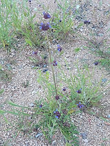
Desert Chia
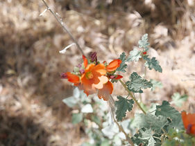
Desert Globemallow
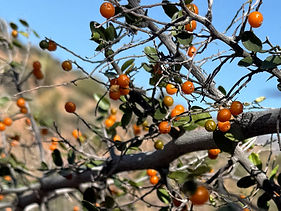
Prickly Pear

Spiny Hackberry
Thistle

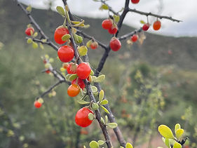
Wolfberry
Nearby Locations
Roosevelt Lake

Tonto National Monument

Apache Trail (Davis Wash)
The Apache Trail is one of Arizona's most scenic drives — 40 miles of steep, winding, mostly unpaved road linking Apache Junction to Roosevelt Lake through the Superstition Wilderness and the Tonto National Forest. Four lakes formed by successive Salt River dams — Canyon, Saguaro, Apache, and Roosevelt — sit along the route, each one a different character of desert reservoir. Davis Wash sits at Apache Lake, 35 miles from Apache Junction on the south shoreline — where the lake meets the desert in a rugged cove of saguaro-covered hillsides and canyon walls.
Luca, Matthew, and I camped two nights here March 6–8, 2026 — at the top of a ravine at 33°34'41.1"N 111°13'07.2"W, west of Davis Wash. Clear weather, no rain in the forecast, and early March wildflowers already in bloom on the hillsides.
The Apache Trail — AZ-88
State Highway 88 — the Apache Trail — was originally built between 1903 and 1905 as a supply road for the construction of Roosevelt Dam. President Theodore Roosevelt traveled it himself for the dam's dedication in 1911, later calling it "the most awe-inspiring and most sublimely beautiful panorama nature has ever created." The last 20 miles from Tortilla Flat to Roosevelt Lake remain unpaved — a single-lane dirt road with sheer drop-offs, hairpin turns, and views of the lake corridor that justify every white-knuckle moment. Maximum vehicle length 40 feet. Not recommended for large RVs or trailers.
⚠️ Current Closure Note: SR-88 is currently closed between Fish Point and the Apache Lake Marina pending ADOT road repairs. Check current road status before visiting. Davis Wash Shoreline Area is also currently under a separate closure order (Forest Order 03-12-06-24-10). FR205 that leads to Davis Wash Shoreline Area has a locked gate. Dispersed camping above the wash on the hilltops south AZ-88 remain accessible.
Our Camp — Top of the Ravine

We set up at the top of the ravine south of AZ-88 at 33°34'41.1"N 111°13'07.2"W — elevated above the wash with the desert spreading around us. The ravine setting provided shelter and privacy while the hilltop walks gave us the open views. A good camp choice in a landscape where the options are worth scouting before committing.
Hike One — Ravine, Washes, and Hilltop Views
The first hike went up the ravine, through the washes, and along the hilltops — a route that required route-finding rather than trail-following but rewarded the effort with views of Apache Lake and the surrounding canyon and mountain country. The lake visible below, the Superstition Wilderness and Four Peaks on the horizon, and the desert itself in full early March bloom.

What we found along the way:
Wildflowers — pink, purple, yellow, and white blooms across the hillsides. Early March in the Sonoran Desert after a wet winter produces exactly this. Mexican poppies, brittlebush, and owl clover on the slopes — and Desert Chia (Salvia columbariae) producing its distinctive purple flower clusters. Desert Chia is one of the most nutritious wild seeds in the Southwest — the same chia species used by the Cahuilla and other Indigenous peoples as a staple food, ground into pinole or mixed with water into a sustaining drink. The seeds are small but dense in omega-3 fatty acids and protein.
Dodder — the bright yellow-orange string-like parasitic plant wound through shrubs and desert plants along the wash. Cuscuta spp. — also called devil's hair, strangleweed, and witch's hair — produces no chlorophyll of its own, attaching to host plants and extracting water and nutrients through haustoria (root-like structures that penetrate the host tissue). The color is unmistakable — neon yellow-orange threads coiled through the host plant like something left behind by a passing alien. Genuinely unusual and worth stopping to look at closely.
Deer prints in the sandy wash bottoms — fresh, clear impressions, evidence of the mule deer working the ravine drainage.
Saguaro — the giant of the Sonoran Desert everywhere on the slopes above and below camp, some of the largest specimens with multiple arms indicating age of 150 years or more.
Hike Two — Davis Wash Road to the Shoreline
The second hike followed FR 250 heading north off AZ-88, along Davis Wash toward the Apache Lake shoreline. The road along the wash is closed to vehicles but open for walking — leading down to the Davis Wash Shoreline Area where a once-functional campground has been reclaimed by the desert.
What we found:
The old campground remnants — signs of what was once a developed recreation site. Boat ramps, benches, and a fire pit now overgrown. The infrastructure of a campground that served visitors for decades, slowly being returned to the desert. The boat ramps are still visible. The benches have disappeared into the vegetation. The fire pit remains.
The lake — we sat by the water for a while, watching boats out fishing Apache Lake. The lake sits quietly while the surrounding canyon walls reflect in the water. Largemouth and smallmouth bass, crappie, catfish, and walleye all inhabit Apache Lake — a productive fishery for those with a boat or a good bank fishing spot.
An active beehive on a rock face — found on the walk back to camp. A substantial colony working a natural cavity in the rock. Given the Arizona bee situation — Africanized honey bees are present throughout the Sonoran Desert — we observed from a respectful distance and moved on without lingering.
A Gila Monster — the highlight of the hike and one of the most memorable wildlife encounters on any Arizona trip. Walking our way back to camp we came across a Gila Monster under a cattle guard. One of the largest lizards native to North America — heavily built, slow-moving, with distinctive bead-like scales in orange and black patterns. The Gila Monster is one of only two venomous lizards in the world. Despite the reputation, Gila Monsters are docile and non-aggressive unless directly threatened or handled. They spend most of their lives underground — a surface sighting is genuinely rare and worth stopping for. Camera was not with us on this hike. The kind of thing you remember regardless.

Apache Lake — What It Is
Apache Lake was formed in 1927 when the Horse Mesa Dam was completed on the Salt River — the third of four dams along the Apache Trail corridor. The lake spans approximately 2,600 acres at full pool, with steep canyon walls rising from the shoreline on all sides. At 1,900 feet elevation it sits lower and warmer than the Rim Lakes to the north — a year-round fishery and spring wildflower destination with easy Phoenix-area access via AZ-88.
The Tonto Basin Ranger District manages the lake corridor — Burnt Corral Campground on the north shore offers 76 developed sites. Apache Lake Marina provides boat rentals, a restaurant, and an RV park on the east end. Davis Wash on the south shore offers the dispersed option for those who want to be away from the developed facilities.
#ApacheTrail #DavisWash #ApacheLake #TontoNationalForest #DispersedCamping #ArizonaCamping #GilaMonster #SpringWildflowers #ArizonaWildlife #AZPlaces #MaricopaCounty #SonoranDesert #AZ88 #FreeCamping #PhoenixDayTrip
Dispersed Camping

Arizona
HQHJ+6GP Roosevelt, AZ

Maricopa County
33°34'41.1"N 111°13'07.2"W
Elevation: 2,400 feet
Directions
From Apache Junction, AZ: Take AZ-88 (Apache Trail) north approximately 35 miles. The last 20 miles are unpaved — narrow, winding, with steep drop-offs. Not recommended for large RVs or trailers. Watch for the Davis Wash turnoff on the left (south) side of the road approximately 9 miles south of Roosevelt Dam. Turn left and follow approximately 1 mile to the shoreline area. For dispersed camping above the wash, scout pullouts and side roads along AZ-88 near the wash for elevated sites. Our campsite: 33°34'41.1"N 111°13'07.2"W.
From Roosevelt Lake / Globe: Head west on AZ-88 from Roosevelt Dam approximately 9 miles to the Davis Wash area on the right (south) side of the road.
⚠️ Current road closure: SR-88 is currently closed between Fish Point and Apache Lake Marina — verify current status with ADOT and the Tonto Basin Ranger District before visiting.


Best Seasons & Temperatures
Fall through spring is the ideal season — mild Sonoran Desert temperatures and spring wildflower bloom make March visits exceptional as we experienced. Winter camping is comfortable at this low elevation. Summer heat is extreme and not recommended for camping. Spring wildflowers peak February through April depending on winter rainfall — check bloom reports before visiting. The unpaved section of AZ-88 becomes treacherous after rain — never attempt after heavy rainfall. Davis Wash Shoreline Area closes periodically due to flash flood risk and public safety orders — verify current status before any visit.
Davis Wash Apache Lake Apache Trail AZ-88 dispersed camping Tonto National Forest Arizona wildflowers Gila Monster
March 6–8, 2026