
Sycamore Canyon (Parsons Trail)
AtoZ Places Bucket Location


Abandoned & Ghost Towns

Ancient Ruins

Caves

Desert

Forest

Historical

Hot Springs

Lakes & Rivers

National & State Parks

Peaks










Parsons Trail is the gateway to Sycamore Canyon Wilderness — Arizona's largest canyon wilderness at 56,000 acres, stretching 21 miles from the Verde Valley floor to the Colorado Plateau rim. A 7.4-mile round trip along Sycamore Creek through towering red sandstone walls leads to Parsons Spring, one of the most rewarding hike-to destinations in central Arizona.
Desert
Lakes & Rivers

Wildlife

Exploring

Hiking

Cell service limited in backcountry — download maps before hiking
No campfires during fire restrictions — before visiting check with the Ranger District or BLM.

No facilities on site — no water, no restrooms
Pets should remain on leash.
Water: No potable water; pack your own supply.
More Info
Plants Foraged
Nearby Locations
Tuzigoot National Monument

Red Rock State Park

Dead Horse Ranch State Park

Palatki Heritage Site

Sycamore Canyon (Parsons Trail)
Sycamore Canyon does not announce itself. From the Verde Valley floor near Clarkdale the canyon entrance is modest — a gap in the hills, a creek bed, a sign at a trailhead at the end of an eleven-mile rough road. Then you descend the quarter-mile rocky path to Sycamore Creek and the canyon reveals itself. Red sandstone walls rising hundreds of feet. A perennial stream cutting through desert. The sound of water in a place that doesn't look like it should have any.
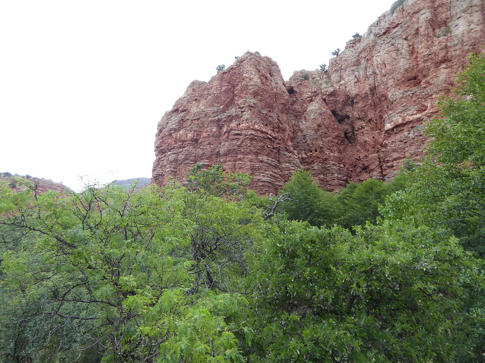
Sycamore Canyon Wilderness encompasses all of Sycamore Canyon, from its pine- and fir-forested rim on the Colorado Plateau down through the Mogollon Rim to its desert mouth in the Verde Valley. The canyon winds for over 20 miles along Sycamore Creek, at places stretching seven miles from rim to rim. Carved walls reveal layers of lovely red sandstone, spectacular white limestone, and rugged brown lava. Pinnacles tower above the high, colorful cliffs. It is one of Arizona's most dramatic and beautiful canyons — and one of its least visited given the rough road access required to reach the Parsons Trailhead.

Arizona's First Wilderness
Sycamore Canyon was established as Arizona's first wilderness on March 2, 1922 — making it one of the oldest designated wilderness areas in the entire United States. It lies within three national forests: Coconino, Kaibab, and Prescott. The only way to visit is on foot or horseback. No bicycles or motorized vehicles are allowed on any trail within the wilderness.
The canyon was once home to Native Americans — former homes and archaeological remnants of both prehistoric inhabitants and later western cowboys can still be found in the canyon.
The Road In
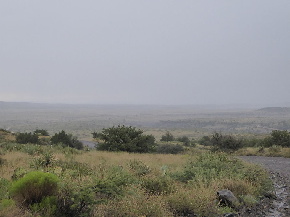
The drive to the trailhead is part of the commitment. From Cottonwood, follow the signs toward Tuzigoot National Monument, cross the Verde River bridge, and turn left onto Forest Road 131 (Sycamore Canyon Road). The road is paved for the first 4.6 miles to the Coconino National Forest boundary, then becomes gravel — running close to the Verde River along the floor of a wide canyon before climbing and crossing open treeless land on Duff Flat. After approximately 3 miles of good gravel the surface deteriorates significantly — uneven, bumpy, and stony across washes and ridges. Total distance from Cottonwood to trailhead is approximately 11 miles. A high-clearance vehicle is recommended. Do not attempt after rain.
The Trail — Parsons to Parsons Spring
The trail begins with a quarter-mile rocky descent to Sycamore Creek — steep enough going down that you'll notice it on the return. At the creek the trail flattens and the canyon opens up. The route follows Sycamore Creek upstream for 3.7 miles to Parsons Spring — crossing the creek multiple times depending on water level. The crossings are the variable element of this hike. In spring snowmelt the creek runs high and crossings require boulder hopping or wading. In late summer and fall the crossings are typically easy. Check creek conditions before visiting.
The canyon grows steadily more dramatic as you progress. The walls rise higher, the red sandstone deepens in color, and the riparian corridor — sycamores, walnuts, cottonwoods, willows — becomes increasingly lush in contrast to the desert rock above. The highlight is Parsons Spring itself — an oasis where water emerges from the ground at the base of the canyon walls in a shaded pool. A remarkable thing to find at the end of a desert hike. In summer the spring and pools above it serve as a swimming hole. A small portion of the canyon from half a mile above Parsons Spring has been closed to overnight camping to protect the riparian ecosystem.
Horses are permitted on the trail but only to the 3-mile mark at the third creek crossing — beyond that the terrain becomes too rough for equestrian travel.
Our Visit — July 28, 2017
Luca and I arrived at the trailhead around midday and spent four hours in the canyon — from 1:45 PM until we made it back to the car just after 6:00 PM. The goal was never to reach Parsons Spring. The goal was the canyon itself — the water, the walls, the exploration. We achieved that fully.
On the drive in we spotted an pronghorn moving through the open desert along the road — a clean start to the afternoon.
The trail descends to Sycamore Creek and the canyon opens immediately. We made our way upstream with multiple creek crossings — wading through, picking lines across rocks, getting wet in the process. The creek crossings are part of the experience. We were not trying to stay dry.
Pronghorn
The main swimming hole at 34°52'54.1"N 112°04'11.5"W was the centerpiece of the afternoon — a deep, clear pool in the canyon with red sandstone walls rising above. We swam. We sat. We explored. The kind of afternoon that doesn't need an agenda to be exactly right.
Along the canyon walls near the swimming hole we found a section of cliff with three large shallow holes — carved into the rock face close to the river. The main swimming hole has one as well. Whether these are natural or worked by human hands we couldn't determine — but the scale and placement of them is striking. They sit at river level, close enough that the walls show the waterline of higher flows. They felt like they had been used.
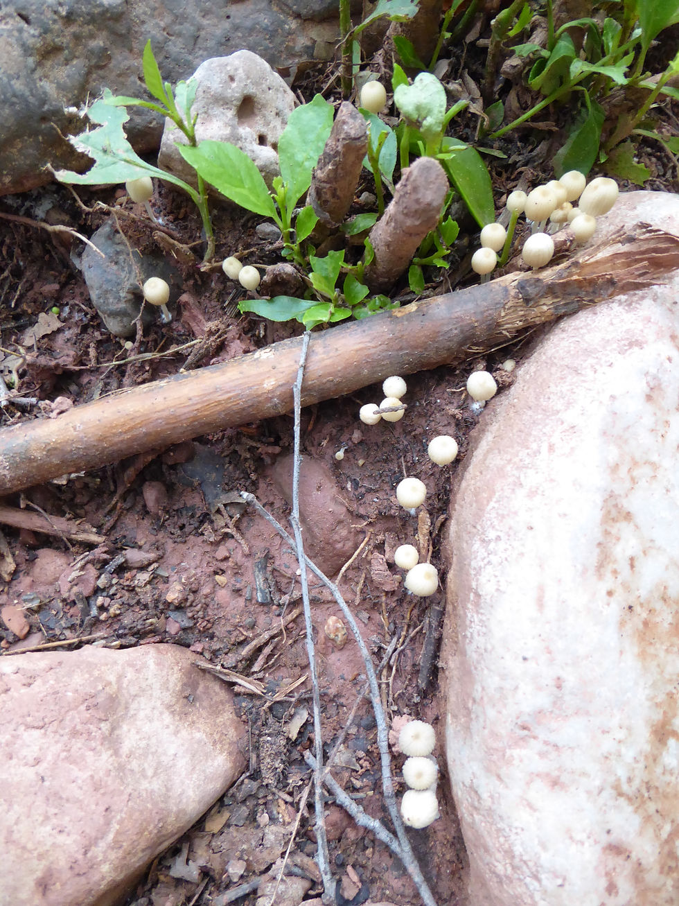
Along the way we spotted crawfish on the creek bottom, fish holding in the current, mushrooms growing in the shade, and something that looked like a red worm with legs — likely a centipede, though the color and movement were remarkable enough to stop us both.
We turned around at approximately 34°53'23.8"N 112°04'18.9"W — roughly halfway to Parsons Spring — when the light started changing and we noticed a storm building in the east over the ridge. We didn't debate it. We started moving.
The storm was faster than us. Right before reaching the final section of the trail — the climb out of the canyon to the trailhead — the monsoon caught up with us fully. Full downpour. Water running down the path we needed to climb. We made it up and to the car completely drenched — the kind of wet that goes through everything. Within a short distance driving out on the road, the ground was dry as if nothing had happened. That is the monsoon in Arizona. It falls hard and fast in one place and the next mile over doesn't know it rained.
A July visit to Sycamore Canyon is not the conventional recommendation — summer heat and monsoon risk are real factors. But the payoff is the creek at its fullest and the canyon completely to yourself. We saw no one else the entire afternoon. If you go in July or August, start early and watch the eastern sky. The storms build fast and the canyon is not where you want to be when one arrives.
Wildlife
Many ringtail cats — wide-eyed cousins of the raccoon — live in the canyon along with black bears, mountain lions, seasonal elk and deer, rattlesnakes, scorpions, and many smaller animals. Canyon wrens send their distinctive descending song along the trail walls. Hermit thrushes call from the riparian thickets. Bird diversity in the canyon is exceptional — the combination of riparian habitat, cliff faces, and diverse vegetation layers attracts species from multiple ecological zones.
Geology — Layers of Arizona's History
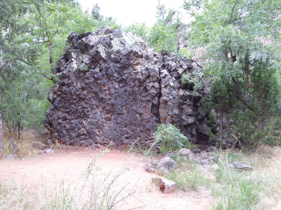
The canyon walls read like a geological timeline — red and buff sandstone at creek level, white limestone in the middle bands, and dark brown lava capping the upper formations. The canyon started forming millions of years ago as Sycamore Creek cut through the lava cap covering the Colorado Plateau and began eroding the softer sandstone beneath. The two-thousand-foot depth of the canyon from rim to creek represents the cumulative work of water over geologic time. The same process that carved Oak Creek Canyon is at work here — but without the highway.
More Information
High clearance vehicle strongly recommended — road is rough and deteriorates after rain
Trail: 7.4 miles round trip, easy to moderate, minimal elevation change on trail itself
Creek crossings variable — check conditions before visiting, especially spring
Horses permitted to 3-mile mark (third creek crossing) only
No bicycles or motorized vehicles in wilderness
Overnight camping prohibited within half mile above Parsons Spring
No camping within wilderness requires permit — backcountry camping permitted with Leave No Trace practices beyond the closed zone
#SycamoreCanyon #ParsonsTrail #SycamoreCanyonWilderness #ParsonsSpring #CoconinoNationalForest #ArizonaHiking #VerdeValley #Cottonwood #ArizonaWilderness #AZPlaces #YavapaiCounty #ArizonaTrails #CanyonHiking #WildernessHiking #SycamoreCreek
Arizona
VW7J+M7 Sedona, AZ

34°51'50.5"N 112°04'09.3"W
Elevation: 3,760 to 3,671 feet
Directions
From Cottonwood, AZ: Head northwest on Main Street and follow signs toward Tuzigoot National Monument. Turn right onto Tuzigoot Road and continue across the Verde River bridge. Immediately after the bridge turn left (north) onto Forest Road 131 / Sycamore Canyon Road. Follow FR 131 approximately 11 miles to the Parsons Trailhead — the first 4.6 miles are paved, the remainder is gravel and rough dirt. High clearance strongly recommended. Do not attempt after rain.


Best Seasons & Temperatures
Fall and spring are ideal — comfortable temperatures and manageable creek crossings. Spring snowmelt can raise the creek significantly making crossings difficult or impossible — check conditions before visiting. Summer heat at 3,700 feet is extreme — avoid midday in summer and carry significant water. Winter is mild at this elevation and the canyon is beautiful in cooler months — one of the best winter hikes in the Verde Valley. The rough access road deteriorates further after rain — check conditions before the drive in.
Sycamore Canyon Parsons Trail Sycamore Creek Verde Valley Arizona Coconino National Forest
July 28, 2017