
Black Canyon Lake
AtoZ Places Bucket Location


Abandoned & Ghost Towns
Caves
Desert
Forest
Historical & Ancient Ruins
Hot Springs
Lakes & Rivers
National & State Parks
Peaks


Lakes & Rivers
Wildlife
Hiking
Boating
Fishing
Exploring
Boating: Electric motors only — no gas engines
Camping: None at location, dispersed sites nearby.
Convenience Store & Gas: Forest Lakes or Heber
Toilets: Vault toilets available.
Water: No potable water; pack in your own supply.
More Info
Have you been here?
Nearby Locations
Willow Springs Lake

Black Canyon (FR 300)

Black Canyon Lake
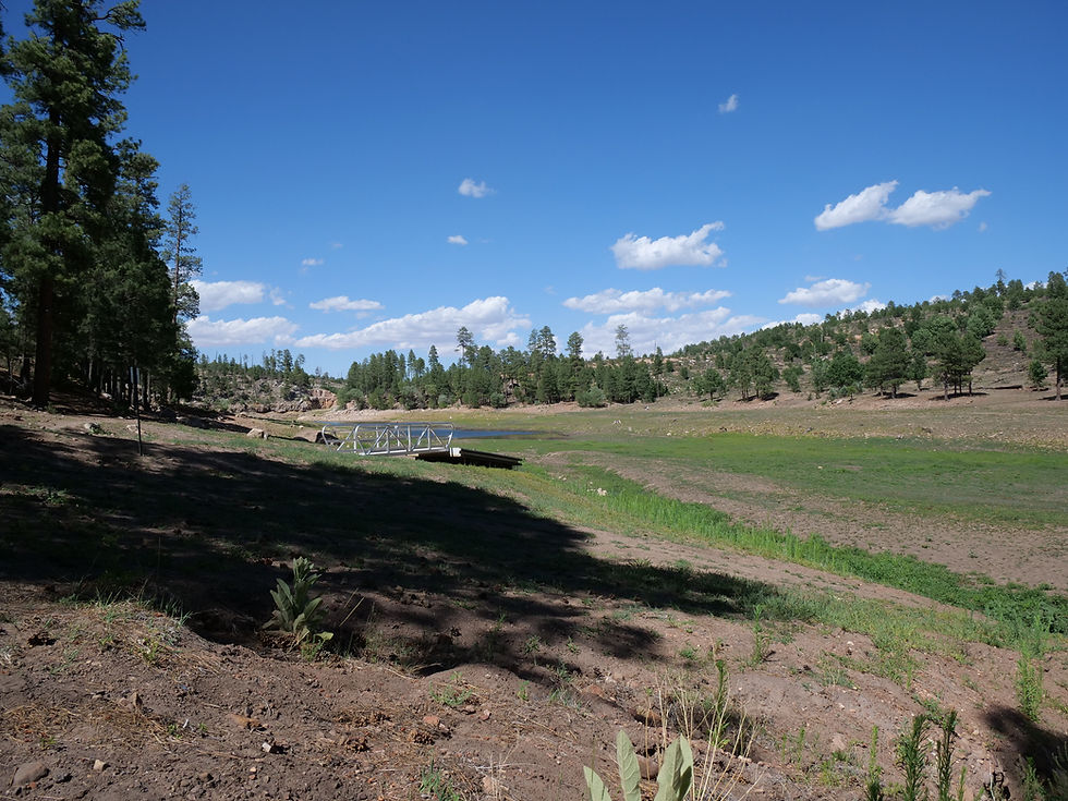
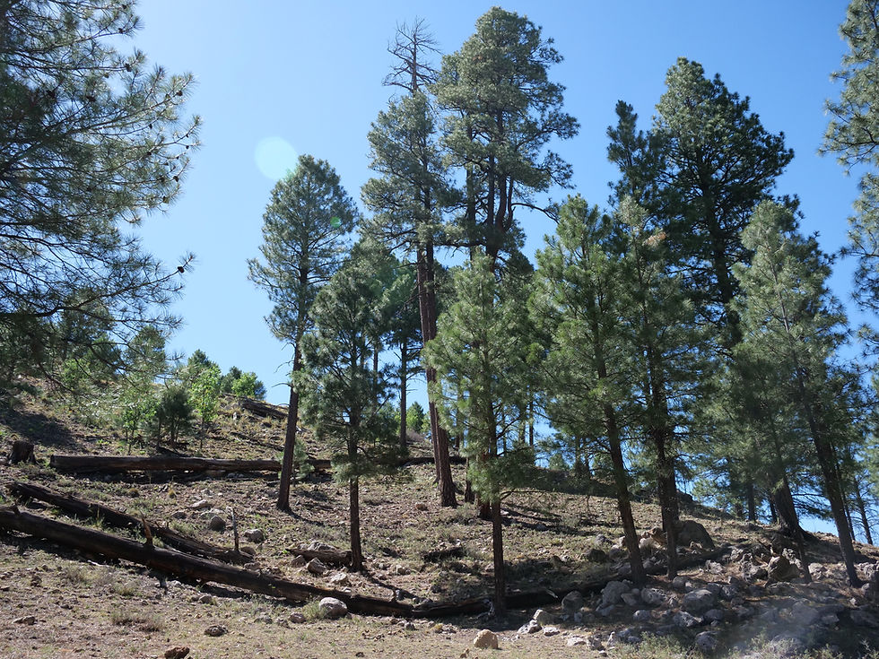
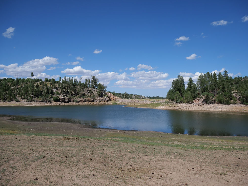
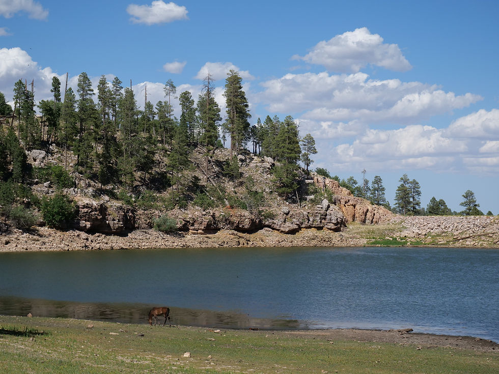
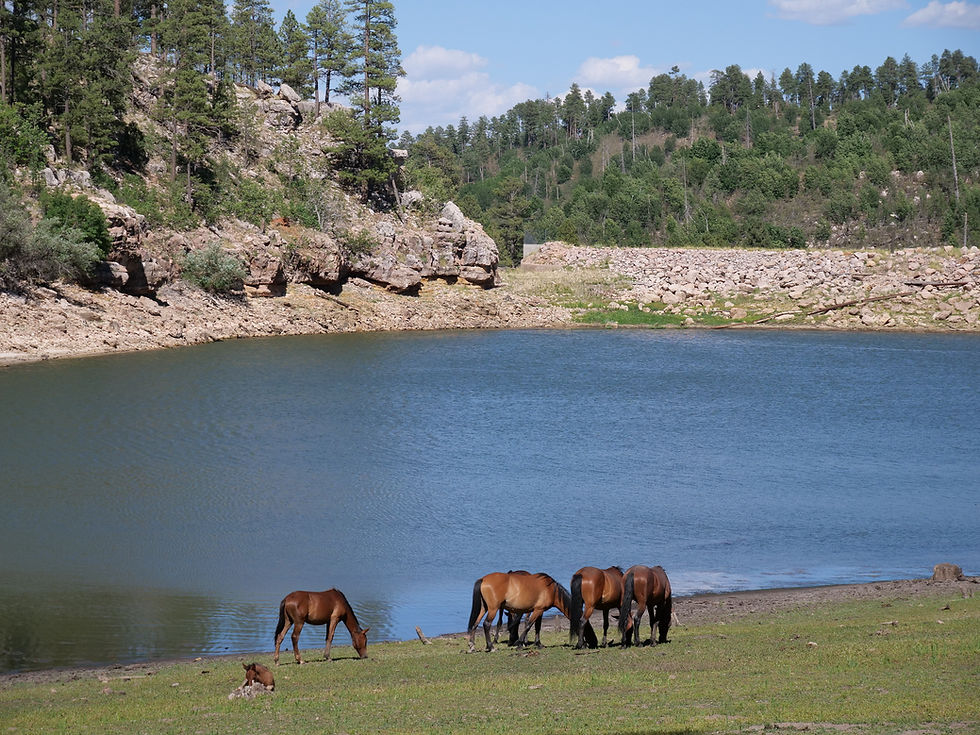
Black Canyon Lake sits quietly off Forest Road 86, tucked into the pines of the Mogollon Rim at 7,060 feet. The lake was built in 1964 by the Arizona Game and Fish Department to provide water recreation opportunities for the public. At 78 surface acres with a maximum depth of 60 feet, it's one of the deeper Rim Lakes — and one of the least crowded.
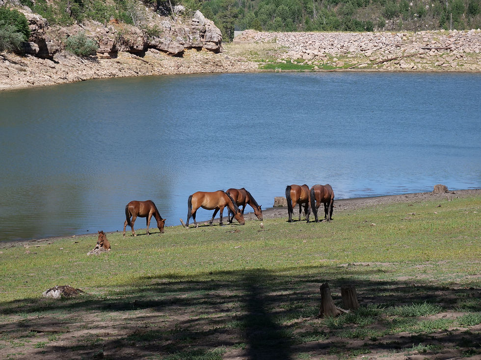
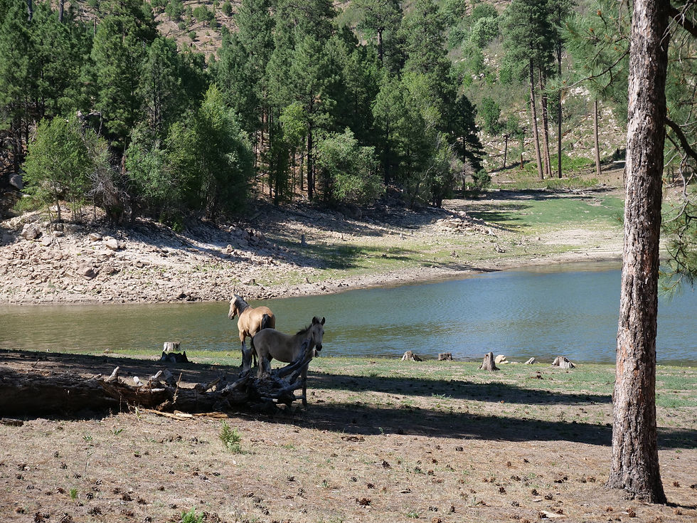
A herd of wild horses is often seen running through the area and stopping at Black Canyon Lake for water. If you've watched our FR 124 Wild Horses video, these are the same horses that roam this stretch of the Apache-Sitgreaves. Seeing them come to the lake is something you don't forget.
Fishing Black Canyon Lake has been managed as a put-grow-and-take fishery. The lake is stocked with catchable-sized rainbow trout, with some largemouth bass and green sunfish also present. Trout fishing is especially productive during spring and early summer stocking periods. Electric motors only — no gas engines on the water.
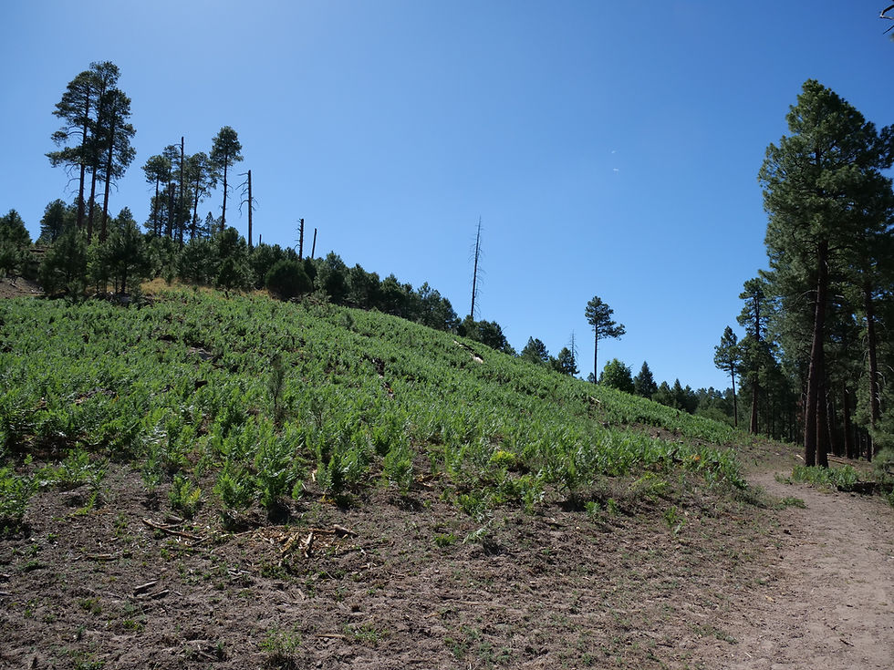
The Fire Impact The lake was affected by the 2002 Rodeo-Chediski Fire, one of the largest wildfires in Arizona history. Because of the danger of falling trees damaged by the fire, the entire area around the lake is limited to day use — overnight camping is prohibited in the immediate area. Although the surrounding forest was adversely affected, a sizeable portion of the lake remains lushly forested and scenic.
Nearby Camping No camping at the lake itself, but Black Canyon Rim Campground is located approximately 2.5 miles southwest — set among towering ponderosa pines and a favorite stopping place for those traveling the General Crook National Recreation Trail. See the Black Canyon Rim bucket list page for full camping details.
A Note on Access Roads to the lake are generally closed from December to early April due to snow. Check road conditions before making the drive, especially in shoulder seasons.
Additional Information
Roads closed December through early April due to snow
Wild horses frequent the area — observe from a distance
Fire restrictions apply — check current status before visit
Nearby camping: Black Canyon Rim Campground (FR 300, ~2.5 miles away)
#BlackCanyonLake #MogollonRim #ArizonaFishing #TroutFishing #ApacheSitgreaves #ArizonaCamping #RimLakes #WildHorses #ArizonaLakes #NatureArizona #AZPlaces #HikeArizona #FishingArizona #ForestRoad86 #ArizonaOutdoors
Arizona
87HX+WM8 Forest Lakes

Navajo County
34.32979, -110.70081
Elevation: 7,060 ft
Directions
From Phoenix, AZ: Take AZ-87 North to Payson, then Highway 260 east toward Heber. Watch for Forest Road 300 turnoff on the south side of Hwy 260 near milepost 291. Turn south on Forest Road 300 and drive 2.4 miles, then turn east (left) on Forest Road 86. Drive approximately 3 miles further to the lake turnoff. (~115 miles, ~2 hours) USDA Forest Service
From Heber: Head west on Highway 260 approximately 15 miles to FR 300. Turn south and follow directions above.

Black Canyon Lake, Apache-Sitgreaves National Forest, Arizona
July 11, 2025