
Edge of the World (FR 231)
AtoZ Places Bucket Location


Abandoned & Ghost Towns

Ancient Ruins

Caves

Desert

Forest

Historical

Hot Springs

Lakes & Rivers

National & State Parks

Peaks




Edge of the World — known officially as East Pocket — is one of the most dramatic free dispersed camping destinations in Arizona, perched at nearly 8,000 feet on the rim of the Mogollon Rim escarpment in the Coconino National Forest with sweeping views of Sedona's Red Rock-Secret Mountain Wilderness, Cottonwood, and Mingus Mountain stretching across the Verde Valley far below.
Forest

Wildlife

Camping

Hiking

Bear Country: Store all food, scented items, and trash in bear boxes where provided. At dispersed sites without bear boxes, store food in a locked vehicle or hung from a tree away from camp.

Camping: Dispersed camping allowed up to 14 consecutive days.

Cell service may be limited — download maps before you go
Dogs should remain on leash
No Trash Services: Pack it in & Pack it Out
No campfires during fire restrictions — before visiting check with the Ranger District or BLM.

No facilities on site — no water, no restrooms
⚠️ Area currently closed — verify before visiting
More Info
Plants Foraged
Indian Paintbrush

Manzanita

Nearby Locations
Howard Pocket (FR 536A)

Edge of the World (FR 231)
The name is accurate. Standing at the rim of East Pocket on FR 231, the land drops away beneath you with the abruptness of a cliff edge — ponderosa pine forest behind you, and 2,000 feet below, an entirely different world of red rock towers, canyon walls, and the Sedona basin spreading to the horizon. The contrast is immediate and total. This is the Mogollon Rim doing what it does best — marking the boundary between two Arizonas.
Edge of the World is the local name. East Pocket is the official one. The location also goes by End of the World and Top of the World. Whatever you call it, the destination is Forest Road 231 (Woody Mountain Road) in the Coconino National Forest south of Flagstaff — approximately 25 miles of unpaved road from the Flagstaff side, with the dramatic rim viewpoints and dispersed camping sites concentrated near the East Pocket Lookout area.
We visited June 5–7, 2026 — two nights at the rim, one of the more memorable camps of recent years, and a visit that took on unexpected significance in the weeks that followed.
The Drive In
FR 231 (Woody Mountain Road) begins from Flagstaff and heads south through ponderosa pine forest for approximately 25 miles before reaching the rim. The road passes Rogers Lake — a seasonal lake bed where the Two Spot Trail offers a hiking detour — and traverses through Arizona State Trust Land before entering the Coconino National Forest. The final stretch borders the Red Rock-Secret Mountain Wilderness to the south.
The road is unpaved — washboarded in sections, with rocks and ruts near the rim. Most reviewers describe it as passable in a standard vehicle in good dry conditions, high clearance makes the approach easier and some of the campsite access roads require it. Do not attempt after rain — sections become muddy and impassable. Allow two to two-and-a-half hours from Flagstaff and be prepared for a longer approach than most camping destinations.
Arriving on a Friday — What to Expect
We arrived on a Friday evening and the area was busy — exactly what you'd expect for a well-known free camping destination on a weekend. Having not been to the area before, we spent time scouting sites before committing. The first stop was the iconic viewpoint (34°58'52.0"N 111°49'37.2"W) — with a stacked rock pillar, that grabs your attention and the sweeping panoramic view of Sedona below that explains why people make the drive. The Red Rock-Secret Mountain Wilderness spread out in every direction below us. Sedona's towers, Cottonwood in the valley, and Mingus Mountain across the way with its white telescope domes visible on the summit.

From the main viewpoint we continued down FR 231 and found a site tucked between two hills with a ravine (34°58'47.1"N 111°47'29.2"W), more sheltered than the exposed rim sites, with trees requiring a short walk to access the views. Not the postcard location but the right choice for two nights with privacy. The more exposed rim sites with the best views had neighbors nearby — trade-offs that come with arriving on a Friday at a popular free site.

If we had continued further down FR 231 there were additional sites with great views — ones we noted during our hike after already having set up camp. Worth exploring the full road before committing to a site. The further you go the more options open up, and some of the better rim sites may be further along than the first viewpoint suggests.
The Views — What You Can See
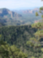
From the Edge of the World at roughly 8,000 feet the view encompasses one of the largest panoramas in central Arizona. Immediately below — the Red Rock-Secret Mountain Wilderness of Sedona. The towers, buttes, and canyon systems of the red rock country are identifiable from above in a way that's impossible from within them. Cathedral Rock, the Wilson Mountain plateau, the Dry Creek basin — all visible and laid out like a topographic model. In the distance — all of Sedona, the Verde Valley, Cottonwood, and across the valley, Mingus Mountain with the observatory visible on the summit. On clear days the view extends to remarkable distances in multiple directions. From our campsite with trees blocking the direct rim view, we walked to several spots to access different angles.
The Hike

From camp we hiked an old forest road now closed to vehicles and camping — a quiet walking route through the pines that offered a different angle on the rim and additional viewpoints into the Red Rock-Secret Mountain Wilderness. The Bell Rock viewpoint from this old road is the standout — seeing Bell Rock from 8,000 feet above and to the north is a completely different relationship with a landmark most visitors see from AZ-179 below.
FR 778 Viewpoint
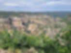
After leaving camp we drove a high clearance required FR 778 tills it end, there we took a short hike reached to the viewpoint (34°59'40.1"N 111°46'39.9"W) an overlook specifically positioned to look down over the Red Rock-Secret Mountain Wilderness from a different angle than the main East Pocket rim. Worth adding to any Edge of the World visit as a secondary viewpoint stop.
What We Witnessed
On our arrival we noticed a group at a nearby site burning a campfire — a violation of the current fire restrictions that prohibit campfires in this area. The regulations are posted and the logic in a drought-stressed ponderosa pine forest at 8,000 feet in late spring is obvious.
Two weeks after we left, on June 19, 2026, the Pocket Fire started approximately 7 miles north of Sedona in the Oak Creek Canyon area and spread rapidly. FR 231 — the same road we camped on — was closed. Evacuations were ordered for Oak Creek Canyon. The fire grew to over 27,000+ acres.
⚠️ CURRENT CLOSURE — POCKET FIRE

FR 231 (Woody Mountain Road) is currently closed past FR 536 due to the Pocket Fire — a wildfire that started June 19, 2026, just two weeks after our visit, and has grown to over 27,393 acres as of August 2026 with 95% containment. The Edge of the World area, Oak Creek Canyon, and large portions of the Coconino National Forest are under formal closure order. Do not attempt to access FR 231 at this time. Check current closure status at fs.usda.gov/r03/coconino/alerts before planning any visit. The area will be closed for an extended period during fire suppression and post-fire assessment.
#EdgeOfTheWorld #EastPocket #FR231 #WoodyMountainRoad #CoconinoNationalForest #SedonaViews #MogollonRim #DispersedCamping #ArizonaCamping #AZPlaces #CoconinoCounty #RedRockSecretMountain #FreeCamping #ArizonaRim #PocketFire
Dispersed Camping

Arizona
X5JF+JG Sedona, AZ

Coconino County
34°58'52" N, 111°49'36" W
Elevation: 6,840 feet
Directions
From Flagstaff, AZ (Woody Mountain Road approach):
Head south from Flagstaff on Woody Mountain Road (FR 231). The road begins as a dirt forest road south of Flagstaff. Follow FR 231 south approximately 25 miles through Rogers Lake and the Arizona State Trust land section into the Coconino National Forest. Watch for the rim viewpoints and dispersed camping areas near East Pocket Knob.


Best Seasons & Temperatures
Late spring through fall is the primary season — the road is typically accessible May through October in dry conditions. June visits are possible but fire risk increases significantly in dry years — check fire restrictions and road closures before any visit. Summer monsoons make the road impassable after rain. Winter brings snow closures. The area is currently closed due to the Pocket Fire — check current status before planning any visit. When open, weekday visits offer dramatically better availability than weekends — the area is extremely popular on summer and fall weekends. Arrive early or midweek to secure the best rim sites.
Edge of the World FR231 East Pocket dispersed camping Sedona red rock view Coconino National Forest
June 5-7, 2026