
Moqui (FR 95)
AtoZ Places Bucket Location


Abandoned & Ghost Towns
Caves
Desert
Forest
Historical & Ancient Ruins
Hot Springs
Lakes & Rivers
National & State Parks
Peaks

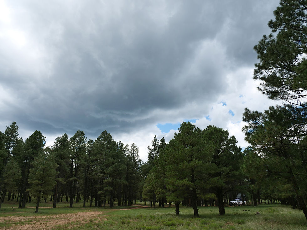


FR 95 is a 30-mile forest road corridor through the Coconino National Forest below the Mogollon Rim — offering some of the best dispersed camping in Arizona, with nearby access to East Clear Creek, the historic Moqui Lookout fire tower, Blue Ridge Reservoir, water play in Barbershop Canyon, and miles of ponderosa pine backcountry to explore.
AZ Places
Forest
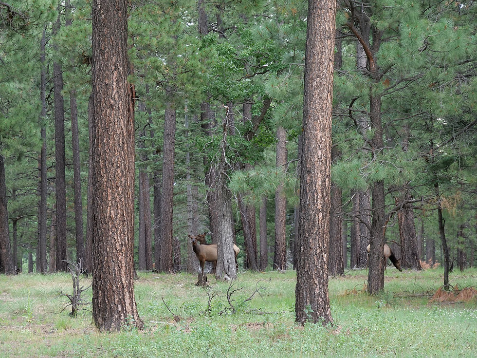
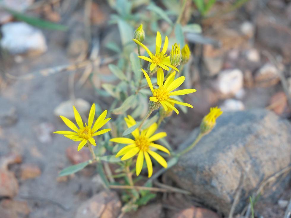
Wildlife
Hiking
Exploring
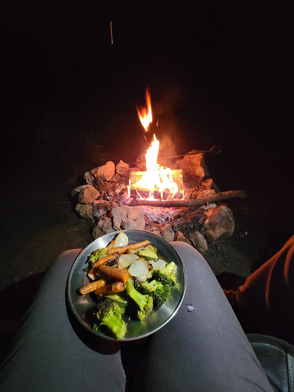
Camping
Camping: Dispersed camping allowed up to 14 consecutive days.
Water: No potable water; pack in your own supply.
More Info
Have you been here?
Nearby Locations
C.C. Cragin Reservoir

Moqui (FR 95)
If you want to escape the heat, get off the main roads, and find a campsite in the pines with no reservations and no crowds, FR 95 is one of the best roads in the Coconino National Forest.
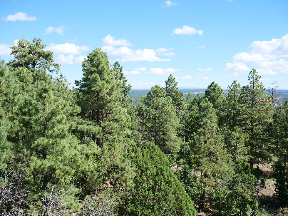
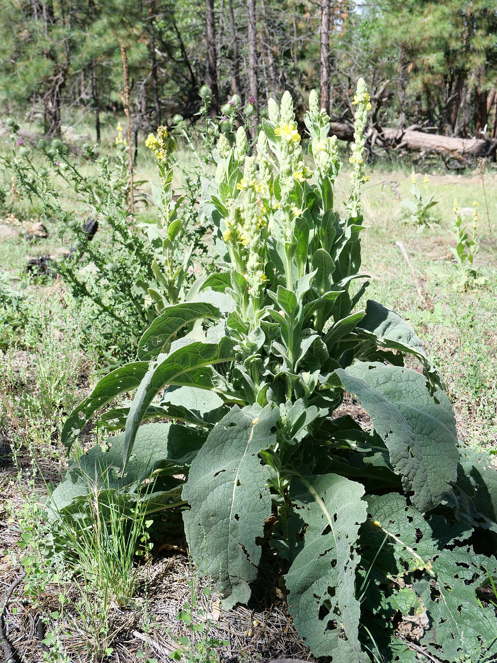
Forest Road 95 runs north from US Route 87 (near Clints Well) all the way up to Rim Road 300 — roughly 30 miles of dirt and gravel through ponderosa pine forest at 6,800 feet, following the East Clear Creek drainage below the Mogollon Rim. Dispersed camping is allowed all along FR 95 and the forest roads that branch off it — no reservations, no fees, just find your spot and set up camp. This is the Rim country most visitors don't see.
We have camped this corridor twice — at FR 95 (coordinates 34.57276, -111.16846) in September 2023, and at FR 513 (coordinates 34.61203, -111.16049) in July 2022. Both sites delivered exactly what you come here for: tall pines, forest silence, cool temperatures, and complete solitude.
Moqui Lookout Fire Tower
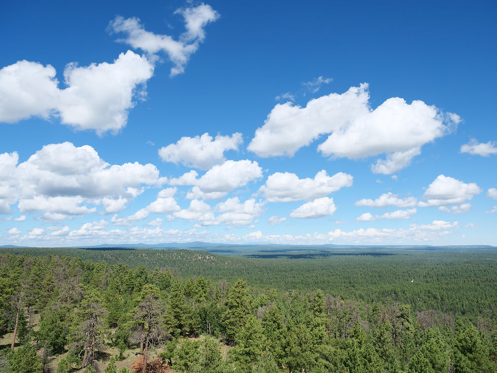
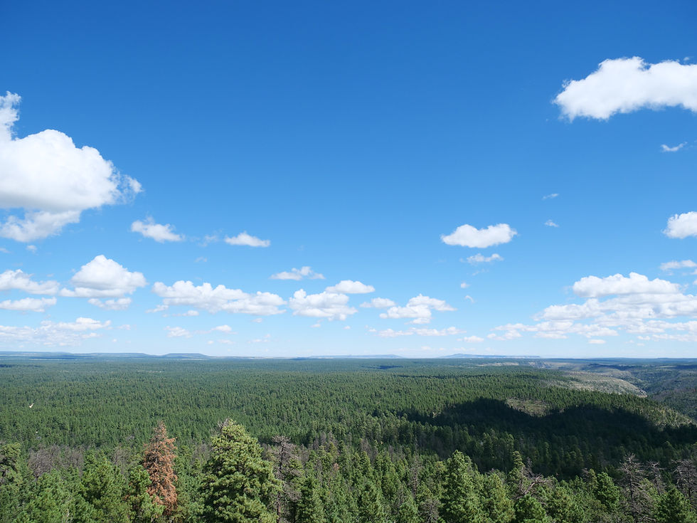
The Moqui Lookout Tower stands 100 feet tall and is one of 11 towers in Coconino National Forest that are still staffed by actual forest rangers during fire season. Built in 1952 and designated a National Historic Lookout on March 15, 2006, the tower sits at an elevation of 7,476 feet. The tower is open to visitors during staffed hours — 8:00 AM to 4:30 PM. Rangers on duty are generally happy to talk about fire detection, the history of the tower, and what they can see from the cab on a clear day. Coconino National Forest includes the largest stand of Ponderosa Pine in the world and also has the most lightning strikes per year — two facts that explain why these towers still matter. GPS: 34°33'51"N, 111°10'09"W
We visited on both July 31, 2022 and September 3, 2023. The elevation at the tower is 7,465 feet — and the views across the Rim country are worth the drive alone.
Blue Ridge Reservoir
70 acres, trout fishing, non-power boating permitted Blue Ridge Reservoir sits at 6,720 feet in the Mogollon Rim area of Arizona. The dam impounds East Clear Creek and the reservoir covers 70 surface acres with an average depth of 147 feet. Trees come down to the water line, making it one of the more scenic reservoirs in the area. Fishing options include rainbow, brown, and brook trout. Boating is permitted. GPS: 34°33'16"N, 111°11'51"W
From the Moqui Lookout area, you can reach Blue Ridge Reservoir via FR 715B — but on our visits the road appeared rough and muddy and we opted not to take it. The alternate and recommended route is to take AZ-87 to FR 751, which provides better access to the reservoir without the rough road conditions.
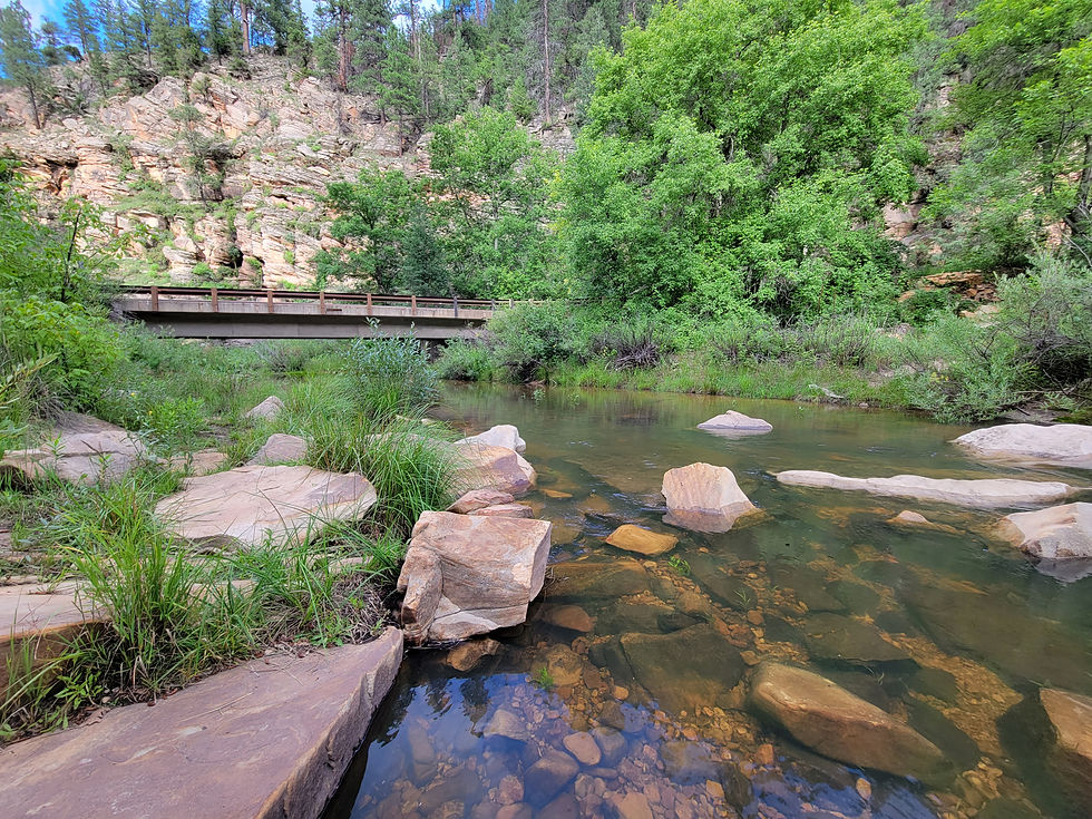
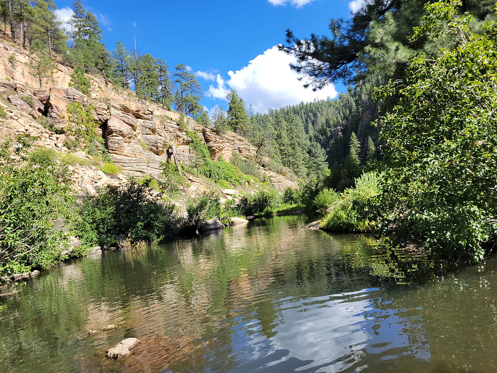
East Clear Creek — Barbershop Canyon
For wading, fishing, and creek access, head to East Clear Creek in Barbershop Canyon. We accessed the creek on September 3, 2023 — a welcome stop after camp. The creek runs through a forested canyon and offers swimming holes, wading, and fishing in a beautiful natural setting.
Route Notes — Getting to Rim Road 300
For a better road and shorter route to Rim Road 300 from FR 95 at East Clear Creek, take FR 96 to FR 137 rather than continuing north on FR 95 all the way. This avoids the roughest section of the upper road and gets you to the Rim more efficiently. Check road conditions before committing to any route — monsoon season can make these roads muddy quickly.
Moqui Group Campground
For those who prefer a developed site in this area, the Moqui Group Campground sits at 6,915 feet surrounded by ponderosa, oak, and aspen. It consists of three individual group sites — Simmons, Spooner, and Ernst — each accommodating up to 50 people with picnic tables, fire rings, grills, vault toilets, trash collection, and piped drinking water. Reservations required via Recreation.gov.
#FR95 #MogollonRim #CoconinoNationalForest #DispersedCamping #EastClearCreek #MoquiLookout #BlueRidgeReservoir #ArizonaCamping #PonderosaPine #ForestCamping #AZPlaces #HappyJack #ArizonaForest #RimCountry #Freecamping
Dispersed Camping
Arizona
Forest Service Rd 513, Happy Jack, AZ 86024
Coconino County

34°34'21.9"N 111°10'06.5"W
Elevation: 6,800 feet
Directions
From Phoenix, AZ: Take AZ-87 North (Beeline Highway) through Mesa, Fountain Hills, Payson, and Strawberry. Continue north on AZ-87 approximately 15 miles past Strawberry to the Clints Well junction. Turn left (north) at Clints Well onto FR 95. Follow FR 95 north into the Coconino National Forest. Dispersed camping begins along the road within the first several miles.
FR 95 camp (34.57276, -111.16846): approximately 4 miles north on FR 95 from the AZ-87 junction
FR 513 camp (34.61203, -111.16049): continue north on FR 95 and turn onto FR 513
To Moqui Lookout: Continue north on FR 95 past the dispersed camping area to the Moqui Lookout spur road. GPS: 34°33'54.1"N 111°10'09.3"W Open 8:00 AM–4:30 PM during fire season
To Blue Ridge Reservoir (recommended route): From AZ-87 at Clints Well, turn north and watch for FR 751. Follow FR 751 west to the reservoir. Avoids the rough FR 715B road from the Moqui area.
To East Clear Creek / Barbershop Canyon: Follow FR 95 north and watch for Barbershop Canyon access points along East Clear Creek. GPS 34°33'00.6"N 111°09'46.9"W area puts you near creek access.

Best Seasons & Temperatures
FR 95 is a four-season corridor at 6,800 feet — comfortable in summer when the Valley is baking, spectacular in fall color, and accessible in spring. Wet summer (monsoon) season brings afternoon thunderstorms and muddy roads — check conditions before committing to the dirt roads off FR 95. Snow is possible in winter and some roads may become impassable. The Moqui Lookout Tower is staffed during fire season (typically April through October) — visit during that window to catch a ranger on duty. Blue Ridge Reservoir via FR 715B can be rough after rain — use the AZ-87/FR 751 approach instead.
Mogollon Rim, Arizona
July 31, 2022 (FR 513 camp) / September 2–4, 2023 (FR 95 camp)