
Mt Lemmon
AtoZ Places Bucket Location


Abandoned & Ghost Towns
Caves
Desert
Forest
Historical & Ancient Ruins
Hot Springs
Lakes & Rivers
National & State Parks
Peaks


AZ Places
Peaks
Forest
Wildlife
Hiking
Exploring
Fishing
Camping
Camping: Dispersed sites available, with a developed campground nearby.
Water: Bring your own. Potable water may be available at the nearby campground.
More Info
Have you been here?
Nearby Locations
Mt Lemmon
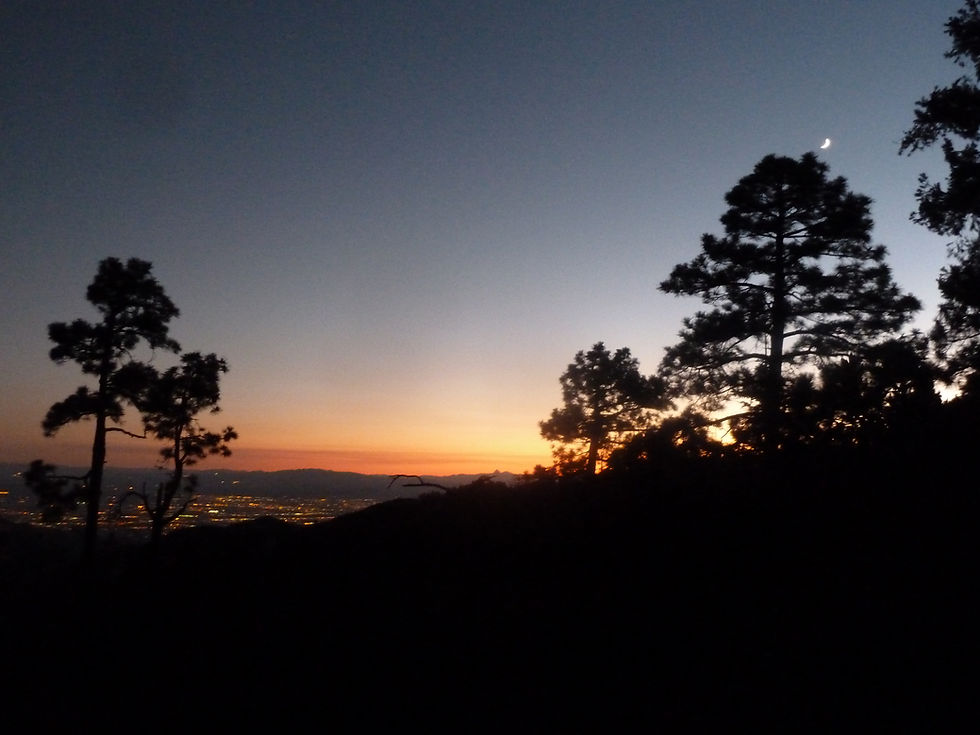
Most people think of Mount Lemmon as a day trip from Tucson — drive up, get cool, drive back. That's selling it short. Mount Lemmon is a full camping destination, and if you find the right dispersed site up here, it's one of the most rewarding camps in southern Arizona.
The Santa Catalina Mountains form one of the largest sky islands of southern Arizona — hills that rise far above the Sonoran Desert plains and harbor climate zones typical of lands much further north. From ancient paleo-Indians 4,000 years ago to the complex Hohokam culture a thousand years ago, the Spaniards of the 1542 Coronado Expedition, and the Apaches and 19th century pioneers of Arizona's Territorial Period, Mount Lemmon and the Catalina Mountains have been sought out by people seeking woodland resources and a respite from the scorching desert floor. That same impulse drives the tens of thousands of Tucsonans who head up here every summer.
The Catalina Highway — Sky Island Scenic Byway
The Catalina Highway — officially the General Hitchcock Highway — is a 27-mile scenic route that ascends from the desert floor in Tucson to near the summit of Mount Lemmon, gaining over 6,000 feet in elevation and showcasing a variety of climates ranging from lowland desert to alpine forests. The drive simulates the experience of driving from Mexico to Canada — pullouts along the way offer exhibits and panoramic views of Tucson and the surrounding mountains. Allow at least one hour of drive time plus stops. The road is winding with blind turns — drive with care and watch for wildlife and cyclists.
The road can close for snow or fire danger — call the road hotline at (520) 351-3351 for current conditions before making the drive.
Dispersed Camping — FR 34 (Mount Bigelow) & FR 3 (Incinerator Ridge)
The two best dispersed camping roads on Mount Lemmon are where we camped — E Mount Bigelow Road (FR 34) at milepost 21 and Incinerator Ridge (FR 3) at milepost 19. Both are free, no reservations, no facilities, and closed December 15 through March 30. Dirt road access — a standard truck or SUV handles these roads fine in dry conditions.
FR 34 takes you up toward Mount Bigelow in mixed conifer at around 8,000 feet. FR 3 / Incinerator Ridge sits just below that elevation with forested sites and a more open ridge feel. Both roads offer the kind of quiet, away-from-the-highway camping that the developed sites on the main road simply can't provide. Come up on a weekday if you can — weekends bring significant traffic to the main highway.
Two other dispersed areas worth knowing: Bear Wallow at milepost 23 and Radio Ridge above Ski Valley — both free, same December 15–March 30 closure dates. N. Oracle Control Road dispersed area is accessible from the junction at milepost 24.5.
Free designated campsites: (Closed Dec 15th – March 30th)
no fees, no reservations, no facilities, dirt road access
Incinerator Ridge (milepost 19 )
Mount Bigelow (milepost 21 )
Bear Wallow (milepost 23 )
Radio Ridge (ABOVE SKI VALLEY)
N. Oracle Control Road (JUNCTION TO ROAD AT milepost 24.5)
Developed Campgrounds
For those who prefer a developed site, Mount Lemmon has a full lineup from bottom to top — Molino Basin and General Hitchcock near the lower pines, Rose Canyon (the largest, with lake access and a small store), Whitetail Group Site (reservation only), and Spencer Canyon near the top with 68 first-come, first-served sites. Rose Canyon Lake is stocked with trout through summer. All developed sites require a fee.
Fee based campsites:
Include amenities such as vaulted toilets, designated fire rings, fee required.
Molino Basin Campground
General Hitchcock Campground
Located at milepost 12, this campground is the lowest one amongst the pines.
Rose Canyon Campground
This campground has spacious campsites is the largest with the most amenities.
Access to Rose Canyon Lake at the end of the campground, it is stocked with trout throughout the Summer months.
Small general store for your camping necessities.
During rainy seasons, Rose Creek meanders through the area.
One-mile trail leading around the lake that is handicapped-accessible.
Whitetail Campground (reservation only group site)
Spencer Canyon Campground
68 first come first served.
Grills, fire pits and tables are provided.
Potable water and vault toilets.
Day Use Areas
buy digital pass at Recreation.gov or on site with cash or check
These areas have designated grills and restroom facilities.
Molino Basin
Cyress
Middle Bear,
Chihuahua Pines
Rose Canyon Lake
Box Elder
Alder
Inspiration Rock
Loma Linda
Marshall's Gulch
Summerhaven
Near the summit is the village of Summerhaven with sit-down restaurants and local food trucks — a genuine mountain village less than an hour from downtown Tucson. It's a welcome stop after a morning of hiking or before heading back down. The Palisades Visitor Center nearby has a bookstore, hosts, and exhibits worth a stop.
Mount Lemmon Ski Valley
Near the summit is a ski center — the southernmost skiing area in the USA, since temperatures on the mountain are up to 30°F cooler than in Tucson. In winter and spring, the ski area draws crowds. In summer the chairlift sometimes operates for sightseeing. Worth knowing about even if skiing isn't your thing — the summit views are exceptional.
More Information additions:
Website: visitmountlemmon.com
Road conditions hotline: (520) 351-3351
Palisades Visitor Center: bookstore, hosts, exhibits — worth a stop
Cabin rentals available: Palisades Ranger Residence and Sollers Cabin — book up to 6 months in advance at Recreation.gov
#MountLemmon #SantaCatalinasMountains #SkyIsland #TucsonArizona #CatalinaHighway #CoronadoNationalForest #ArizonaCamping #DispersedCamping #MtLemmon #SkyIslandScenic #ArizonaHiking #SouthernArizona #AZPlaces #RoseCanyonLake #MtLemmonSki
Campground
Dispersed Camping
Arizona
Tucson, Pima County, Arizona
Pima County

32° 26′ 34.66″ N, 110° 47′ 18.52″ W
Elevation: 5,157 feet - 9,159 feet
Directions
From Phoenix, AZ: Take I-10 South approximately 100 miles to Tucson. Take Exit 275 (Ina Road) or follow I-10 to the Tanque Verde Road exit. Head east on Tanque Verde Road to the Catalina Highway junction. Turn left (north) onto the Catalina Highway and follow it up the mountain — 27 miles to the summit. (~130 miles, ~1 hour 45 minutes — verify with Google Maps)
To FR 34 (Mount Bigelow dispersed camping): Continue on Catalina Highway to milepost 21. Turn onto E Mount Bigelow Road (FR 34) on the right. Dispersed sites begin along the road.
To FR 3 (Incinerator Ridge dispersed camping): Continue on Catalina Highway to milepost 19. Turn onto FR 3 / Incinerator Ridge Road. Dispersed sites along the road.
Road conditions hotline: (520) 351-3351 — call before driving up, especially in winter or after storms.

Best Seasons & Temperatures
Mount Lemmon is a true four-season destination. Summer is peak season — temperatures run 20–30°F cooler than Tucson, making it the go-to escape during dry summer heat. Monsoon season brings dramatic afternoon storms and lightning — be off exposed ridges by early afternoon. Fall offers cooler temps and good color in the aspens near the summit. Winter brings snow and occasional road closures — call the road hotline (520) 351-3351 before driving up. Dispersed camping roads FR 34 and FR 3 close December 15 through March 30. Spring is excellent once the road reopens. Day use fee required at most developed areas — America the Beautiful pass accepted.
Mt Lemmon - Tucson, Arizona
September 3-5, 2016 / June 23-24, 2007