
Fish Creek Canyon Wilderness (The Twist)
AtoZ Places Bucket Location


Abandoned & Ghost Towns

Ancient Ruins

Caves

Desert

Forest

Historical

Hot Springs

Lakes & Rivers

National & State Parks

Peaks


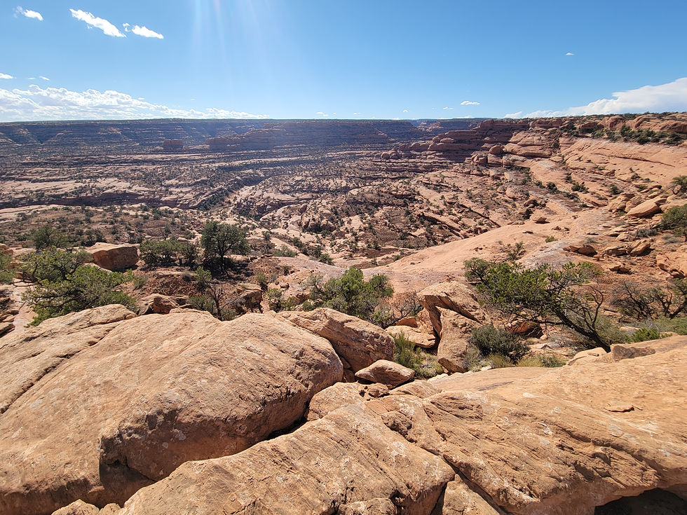


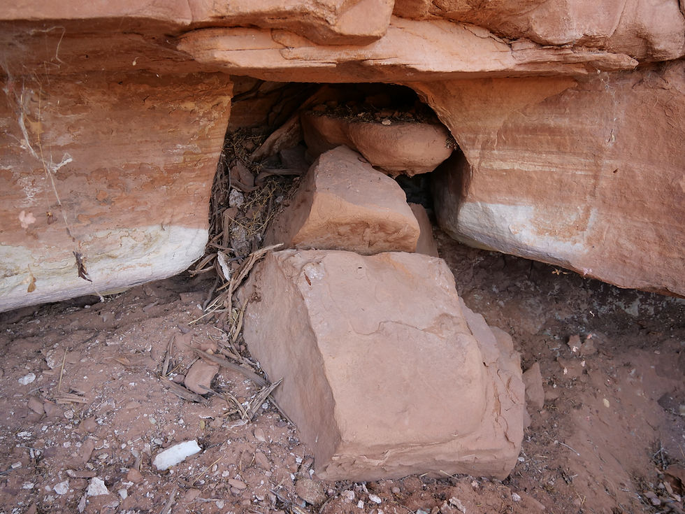


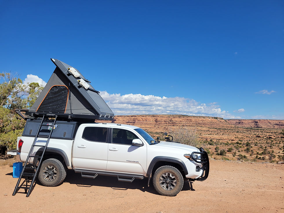



Fish Creek Canyon Wilderness Study Area on Cedar Mesa in San Juan County, Utah is one of the most remote and rewarding backcountry destinations in the Bears Ears region — deep canyons reaching 700 feet, natural arches, Ancestral Puebloan ruins, and the historic Emigrant Trail route followed by Mormon pioneers in 1879, accessed via the rugged Snow Flat Road (BLM 237) through some of the most spectacular canyon country in the Southwest.
Desert
Ancient Ruins

Exploring

Camping

Hiking
Cell service nonexistent — download maps and have paper backup

Dogs should remain on leash
No campfires during fire restrictions — before visiting check with the Ranger District or BLM.
Permits required for all day-use and overnight stays
Water: No potable water; pack your own supply.
More Info
Plants Foraged
Nearby Locations
Valley of the Gods

Sand Island Petroglyphs
Muley Point

Fish Creek Canyon Wilderness (The Twist)
Cedar Mesa holds more history per square mile than almost anywhere else in the American Southwest. The Fish Creek Canyon Wilderness Study Area on its southern edge is the kind of place that rewards people willing to navigate a rough road and sit with the solitude — deep winding canyons, slickrock formations, fins and alcoves, Ancestral Puebloan ruins in the canyon walls, and views stretching to Bears Ears, Sleeping Ute Mountain, and the Abajo Mountains in every direction.
We camped here on September 8, 2025 — at The Twist on Snow Flat Road, part of our five-day northern Arizona and southern Utah loop that included Navajo National Monument, Monument Valley, Valley of the Gods, Moki Dugway, Muley Point, and Sand Island Petroglyphs. Fish Creek Canyon was the night between Muley Point and Sand Island — a camp that added a completely different layer to the trip.
The Road In — Snow Flat Road (BLM 237)
Snow Flat Road is not a road to attempt without preparation. The route runs between Highway 261 and Comb Wash Road at Highway 163 south of Blanding — mostly rock and gravel with some sand and slickrock. It is part of the historic Emigrant Trail — Snow Flat Route, a segment of the Hole-in-the-Rock Trail. High-clearance 4WD is strongly recommended. In wet conditions even 4WD vehicles can find themselves stuck in the slick mud — the road becomes impassable when wet, especially through Comb Wash. Do not attempt after rain.
The views along the ridgeline route in every direction are exceptional — Bears Ears to the north, Sleeping Ute Mountain to the northeast, the Abajo Mountains in the northern distance, and south toward Arizona. On our drive near Comb Ridge we captured a dust devil spinning across the open desert — a perfect moment of nature's power in this wild, open landscape.
Maps are available at the Kane Gulch Ranger Station just north of the Snow Flat Road turnoff on Highway 261, south of SR-95.
The Wilderness Study Area
Fish Creek Canyon WSA encompasses four main canyons reaching up to 700 feet in depth — winding, dramatic canyon systems containing numerous rock fins, alcoves, pinnacles, step-like pour-offs on the canyon floors, and impressive natural arches. In addition to pinyon-juniper woodland and sagebrush, ponderosa pine is found in the drainages of the northern part of the WSA. The landscape is immense, remote, and largely unchanged from when the Ancestral Puebloan people lived here.
We camped among slickrock formations and canyon walls at The Twist and hiked into a nearby canyon to explore the desert terrain — the kind of exploration that doesn't need a destination to be worthwhile.
The Ancestral Puebloan History
The Fish Creek Canyon WSA includes land extensively occupied by Ancestral Puebloan dwellers from approximately 200 AD to 1300 AD. Towers and dwellings still mark the mesas and canyon alcoves throughout the region. The stabilized archaeological site at Comb Wash Overlook has four tower bases, a wall on the mesa rim, and rock shelter dwellings below — visible evidence of the communities that inhabited this canyon country for over a thousand years before abandoning the region in the late 1200s.
The mix of geological drama and human history concentrated in this landscape is what makes Cedar Mesa one of the most remarkable backcountry destinations in North America. The Ancestral Puebloan ruins are not in a museum or behind glass — they are in the canyon walls and on the mesa tops, exactly where they were left.
The Emigrant Trail — Hole-in-the-Rock History

The Hole-in-the-Rock Trail is one of the most remarkable chapters in American pioneer history. In 1879–1880, a company of Mormon settlers departed from Cedar City, Utah on a mission to establish a settlement in the San Juan region. The route they took — across some of the most rugged canyon country in North America — required blasting a passage through a narrow crack in the canyon wall at Lake Powell and lowering wagons down a near-vertical 2,000-foot drop to the Colorado River below. The party of 236 people and 83 wagons completed the journey and founded the town of Bluff, Utah — a journey of extraordinary hardship and determination.
Snow Flat Road follows a section of that historic route — you are driving on the same ground the wagons crossed in 1879. The physical connection to that history is immediate and tangible on this road in a way that historical markers alone cannot provide.
The Dust Devil
Near Comb Ridge on our drive we captured a dust devil spinning across the open desert — one of those spontaneous moments of desert spectacle that the canyon country of southeastern Utah produces without warning. A column of rotating wind picking up sand and debris from the desert floor, visible for miles in the open landscape. A small but perfect example of the forces that have been shaping this landscape for millions of years.
Ranger Station
Kane Gulch Ranger Station
SR-261, south of SR-95, San Juan County, Utah
Open: March 1–June 15 and September 1–October 31, daily 8 AM–Noon
Cedar Mesa Permit Office: (435) 587-1510
Monday–Friday 8 AM–Noon (except federal holidays)
More Information
Day-use permit: $2/person/day or $5/person/week — self-pay tubes at trailheads or Kane Gulch Ranger Station
Overnight permit: $8/person/trip (high season) — reservations via Recreation.gov, must be picked up in person at Kane Gulch Ranger Station on day of trip
Overnight permits limited to 20 visitors per trailhead per day — 12 reservable, 8 walk-in first-come first-served
No permit required to transit approved BLM roads — only required if parking and hiking
High-clearance 4WD strongly recommended for Snow Flat Road
Do not attempt Snow Flat Road or Comb Wash after rain — impassable when wet
Kane Gulch Ranger Station: SR-261 south of SR-95, open high season only
#FishCreekCanyon #CedarMesa #TheTwist #SnowFlatRoad #BearsEars #CombRidge #HoleInTheRockTrail #EmigrantTrail #UtahBackcountry #AZPlaces #SanJuanCounty #AncestralPuebloans #BLMUtah #CanyonCamping #4WDUtah
Dispersed Camping

Utah
97H7+VGF Bluff, UT

San Juan County
37°22'46.9"N 109°44'10.3"W
Elevation: 5,160 feet
Directions
From Highway 261 (primary approach):
From the junction of US-191 and SR-261 south of Blanding, head south on SR-261 approximately 4 miles. Watch for the Kane Gulch Ranger Station on the right — stop here for maps and permits. Continue south on SR-261 to the Snow Flat Road (BLM 237) turnoff. Turn left (east) onto Snow Flat Road and follow to The Twist camping area on Cedar Mesa. High-clearance 4WD required. Do not attempt after rain.
From Bluff, UT (south approach via Comb Wash):
From Bluff head north on US-191. Turn left onto Comb Wash Road at Highway 163. Follow Comb Wash Road north — the road crosses Comb Wash and connects to Snow Flat Road (BLM 237). Follow Snow Flat Road west to The Twist. ⚠️ Comb Wash is impassable when wet — do not attempt after rain.
From Mexican Hat, UT:
Head north on US-163 to the junction with US-191. Continue north to the Comb Wash Road turnoff or continue to SR-261 for the northern approach.


Best Seasons & Temperatures
Spring and fall are the only recommended seasons — March through June and September through October. Summer heat at this elevation is manageable but water sources are unreliable. Winter brings snow and ice making Snow Flat Road impassable. The Kane Gulch Ranger Station is open March 1–June 15 and September 1–October 31 — our September 8 visit fell within the high-use season permit window. Never attempt Snow Flat Road or Comb Wash Road after rain — these roads become dangerously muddy and impassable even in 4WD. Download maps and have paper backup before leaving pavement — cell service is nonexistent in this area.
Fish Creek Canyon Wilderness Study Area The Twist Cedar Mesa Comb Ridge Utah Bears Ears camping slickrock
September 8, 2025