
Muley Point
AtoZ Places Bucket Location


Abandoned & Ghost Towns

Ancient Ruins

Caves

Desert

Forest

Historical

Hot Springs

Lakes & Rivers

National & State Parks

Peaks

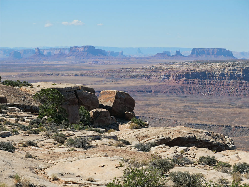


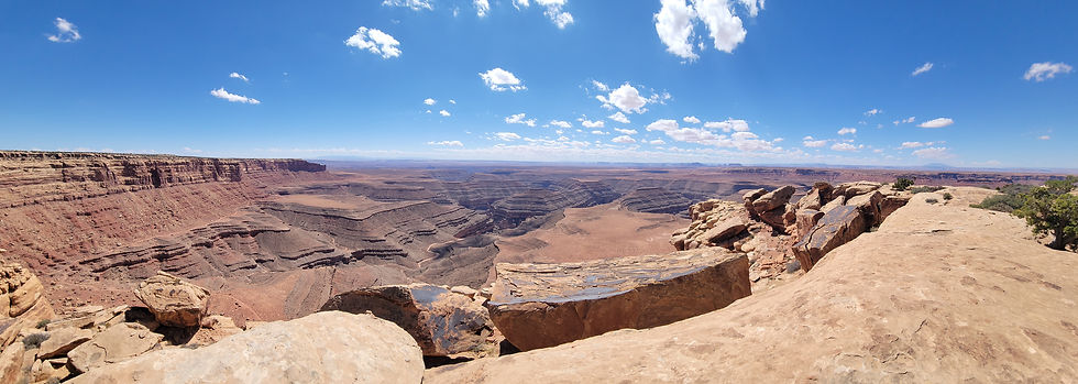

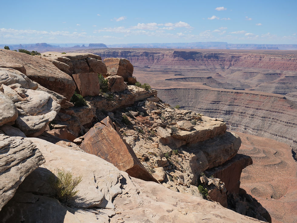


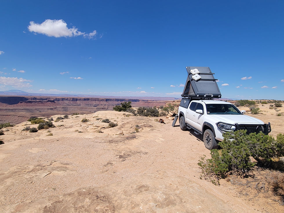


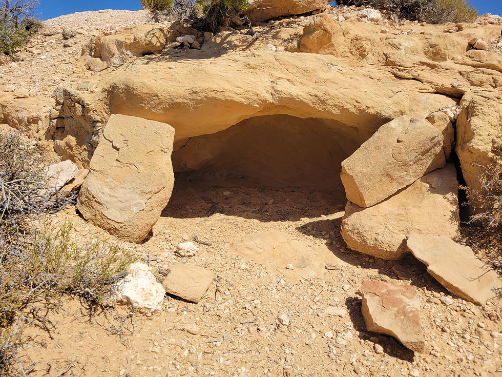
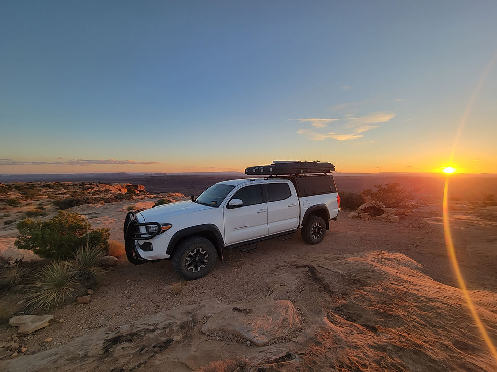




Muley Point on Cedar Mesa near Mexican Hat, Utah is one of the finest and least known dispersed camping overlooks in the American Southwest — perched 2,400 feet above the San Juan River canyon on BLM land with panoramic views stretching to Monument Valley, the Goosenecks, Valley of the Gods, and the Four Corners region, accessible via a five-mile gravel road with no fees and no reservations.
Desert

Exploring

Camping

Camping: Dispersed camping allowed up to 14 consecutive days.

Cell service may be limited — download maps before you go
Dogs should remain on leash
No Trash Services: Pack it in & Pack it Out
No campfires during fire restrictions — before visiting check with the Ranger District or BLM.
Pack out all waste including human waste — wag bags recommended
Water: No potable water; pack your own supply.
More Info
Plants Foraged
Nearby Locations
Valley of the Gods

Sand Island Petroglyphs
Fish Creek Canyon Wilderness (The Twist)
Navajo National Monument

Muley Point
Some places stop you mid-sentence. Muley Point is one of them.

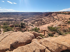
Perched 2,400 feet above the San Juan River canyon on the southern edge of Cedar Mesa near Mexican Hat, Utah — Muley Point is one of those overlooks that makes you recalibrate your understanding of scale. The canyon drops away beneath the rim in sheer vertical walls of sandstone. The San Juan River bends through the canyon system far below. Monument Valley rises in the south. Valley of the Gods spreads to the north-east. The Goosenecks of the San Juan, the Four Corners region, Glen Canyon National Recreation Area — all visible on a clear day from a single point on the rim.
We spent one night here in September 2025, camped right near the rim's edge with the canyon dropping beneath us and Monument Valley visible in the distance.
The Setting — Cedar Mesa and the San Juan River Canyon
Cedar Mesa is a broad sandstone plateau rising above the San Juan River drainage in San Juan County, Utah — one of the most archaeologically and geologically significant landscapes in the American Southwest. The mesa top sits at approximately 6,200 feet with the canyon walls dropping to the river over 2,000 feet below. The southern edge of Cedar Mesa where Muley Point sits is the most dramatic section of that rim — an exposed overlook where the full depth of the canyon system is visible in a single sweeping view.
The San Juan River below carved these canyons over millions of years — the same river that created the famous Goosenecks, visible approximately 10 miles to the east where the river bends through a series of entrenched meanders that drop only one mile as the crow flies but follow six miles of river channel. From Muley Point the canyon system connecting these features is visible as a unified landscape — one of those views that makes the geological timeline of the Colorado Plateau feel comprehensible.
The Access — Moki Dugway and SR-261
Muley Point sits at the end of a five-mile gravel road off SR-261 — accessible to most vehicles in dry conditions. The approach from the south via Mexican Hat is the more memorable route, climbing the Moki Dugway — a steep, winding gravel switchback road with an 11% grade gaining 1,200 feet from the desert floor to the top of Cedar Mesa. The Moki Dugway is not recommended for vehicles over 20 feet or for those with a fear of heights — the drop-offs are severe and there are no guardrails. From the top the view back down to Mexican Hat and the Valley of the Gods is extraordinary. The approach from the north via Blanding on SR-261 is more straightforward — a paved highway to the SR-261 turnoff and then the five-mile gravel road to the point.
Our Visit — September 2025
We camped right at the rim's edge — the canyon 2,400 feet below, Monument Valley on the horizon. The September light on the canyon walls through the afternoon was exceptional — the sandstone warming and deepening as the sun dropped. Square blocks of sandstone visibly chipping away from the cliff faces below — the ongoing geological work of freeze, thaw, and gravity continuing at the same pace it has for millions of years. Lizards worked the warm rock throughout the afternoon, moving in and out of the cracks and crevices.
The sunset over the desert was the centerpiece of the evening — the canyon system turning from red to orange to purple as the light died. The moon rose over the canyon after dark, illuminating the rim and the canyon walls below in a way that made the scale even more apparent than daylight had. And before the night was out a camp mouse found its way into our dishes — a small uninvited guest and a reminder that even the most remote rim-edge camps have local residents.
What You Can See
On a clear day from Muley Point the panorama encompasses an extraordinary range of Southwest landmarks:
Monument Valley — the iconic buttes and mesas of the Navajo Nation rising from the desert 30 miles to the south. The Mittens, Merrick Butte, and the full Monument Valley skyline are visible on the horizon.
Goosenecks of the San Juan River — the entrenched meanders of the San Juan visible approximately 10 miles to the east from the Muley Point rim.
Valley of the Gods — the red rock formations of Valley of the Gods spread below the mesa to the southeast — a miniature Monument Valley accessible by dirt road.
Four Corners Region — the convergence of Utah, Colorado, Arizona, and New Mexico visible in the broader landscape from the high mesa rim.
Glen Canyon National Recreation Area — the canyon country extending west and north into the Glen Canyon drainage.
Dispersed Camping on the Rim
No fees. No reservations. No facilities. BLM land — you drive to the point, find a spot, and camp. The rim-edge sites are the prize — nothing between you and a 2,400-foot canyon drop except the sandstone at your feet. Camping here requires commitment to Leave No Trace — pack out everything, human waste included, and camp on previously impacted surfaces away from the rim vegetation.
Contact
BLM Monticello Field Office
365 N. Main Street, Monticello, UT 84535
(435) 587-1500 blm.gov/utah/monticello
More Information
Moki Dugway: not recommended for vehicles over 20 feet, not recommended in wet or icy conditions, severe drop-offs with no guardrails
Five-mile gravel access road from SR-261 — accessible to most vehicles in dry conditions
Camp on previously impacted surfaces only — stay back from rim vegetation
#MuleyPoint #MexicanHat #UtahCamping #CedarMesa #SanJuanRiver #MonumentValley #BLMCamping #DispersedCamping #SouthwestUSA #AZPlaces #UtahOutdoors #CanyonCountry #MokiDugway #ValleyOfTheGods #Goosenecks #UtahTravel #HiddenGems #OverlookCamping #GlenCanyonNRA #FourCorners
Dispersed Camping

Arizona
62M4+6P Mexican Hat, UT

San Juan County
37°13'59.4"N 109°59'35.9"W
Elevation: 6,200 feet
Directions
From Mexican Hat, UT (southern approach — Moki Dugway):
Head north on US-163 from Mexican Hat approximately 2 miles. Turn left (north) onto SR-261. Follow SR-261 north — the road climbs the Moki Dugway, a steep gravel switchback road gaining 1,200 feet with an 11% grade. Not recommended for vehicles over 20 feet. At the top of Cedar Mesa continue north on SR-261 approximately 5 miles. Watch for the Muley Point Road turnoff on the left (west). Follow the gravel road approximately 5 miles to the point. GPS: 37°13'59.4"N 109°59'35.9"W.
From Blanding, UT (northern approach — paved):
Head south on US-191 from Blanding approximately 4 miles. Turn right (south) onto SR-261. Follow SR-261 south approximately 28 miles through Natural Bridges National Monument junction area. Watch for the Muley Point Road turnoff on the right (west). Follow the gravel road approximately 5 miles to the point.


Best Seasons & Temperatures
Spring and fall are the ideal seasons — mild temperatures, clear skies, and the best light for canyon photography. September is excellent as we experienced — warm days, cool nights, exceptional sunset and moonrise light on the canyon walls. Summer heat at 6,200 feet is manageable but the gravel access road and exposed rim camping can be uncomfortable in July and August. Winter brings snow and ice to Cedar Mesa — SR-261 and the Moki Dugway can be treacherous or impassable in winter conditions. The Moki Dugway should never be attempted in wet or icy conditions regardless of season.
Muley Point San Juan River canyon sunset Monument Valley Cedar Mesa Mexican Hat Utah BLM dispersed camping
September 7, 2025