
Valley of the Gods
AtoZ Places Bucket Location


Abandoned & Ghost Towns

Ancient Ruins

Caves

Desert

Forest

Historical

Hot Springs

Lakes & Rivers

National & State Parks

Peaks




Valley of the Gods near Mexican Hat, Utah is the lesser-known cousin of Monument Valley — a 17-mile BLM loop road through isolated sandstone buttes, mesas, and spires carved from 250-million-year-old Cedar Mesa sandstone, with free dispersed camping on the valley floor, no fees, and formations named Seven Sailors, Castle Butte, Rooster Butte, Setting Hen, and more.
Desert
Ancient Ruins

Wildlife

Hiking

Exploring

Camping

Camping: Dispersed camping allowed up to 14 consecutive days.

Cell service may be limited — download maps before you go
Dogs should remain on leash
Fire Restrictions: No campfires — gas stoves only
No facilities on site — no water, no restrooms
Pack out all waste including human waste — wag bags recommended
More Info
Plants Foraged
Nearby Locations
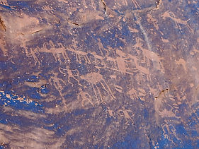
Sand Island Petroglyphs
Fish Creek Canyon Wilderness (The Twist)
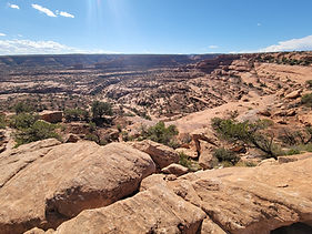
Muley Point

Navajo National Monument

Valley of the Gods
Monument Valley gets the fame. Valley of the Gods gets the solitude.
Fifteen miles from Bluff and just below the south face of Cedar Mesa, Valley of the Gods is what Monument Valley looks like without the entrance fee, the tour buses, and the tribal park infrastructure. Cedar Mesa sandstone buttes and mesas rise from the desert floor in the same dramatic, isolated fashion — carved by 250 million years of water, wind, and ice from the same geological formation. The road through it is 17 miles of gravel, the camping is free, and on a September afternoon it can feel like you have the whole valley to yourself.
We drove through on September 7, 2025 — part of our five-day northern Arizona and southern Utah loop. The original plan was to camp here and we had already scouted several sites on OnX before leaving. Our guide at Monument Valley changed the plan — his recommendation was to go straight to Muley Point and not miss a night on that rim. We took his advice, drove through the Valley of the Gods confirming the camp spots we had scouted for a future visit, stopped for a late lunch below Castle Butte, and continued on to the Moki Dugway and Muley Point.

The Valley delivered exactly what we came for — even without spending the night. The drive through the formations, watching the landscape change as the road circled Castle Butte and passed each named feature, was genuinely remarkable. The desert hues of the sandstone against the big sky of the Colorado Plateau, the scale of the buttes rising from the flat valley floor, the sense of space in every direction — this is one of those drives that doesn't need a destination to justify itself.
The Geology — 250 Million Years
The formations in Valley of the Gods are carved from Cedar Mesa Sandstone deposited during the Permian Period approximately 250 million years ago — when this entire region was covered by a shallow inland sea. Shifting coastal sand was compressed into the layered, variegated sandstone visible in the formations today. Gold, red, and purple hues in many of the buttes reflect different mineral compositions within those ancient layers. The erosion that created the valley's isolated mesas and spires is ongoing — these formations are actively being shaped by water, wind, and ice, just as they have been for millions of years.
The Formations
The valley was named by prospector Albert Christensen in the 1940s, who likened its towering sandstone formations to the gods of mythology. The major named formations along the 17-mile loop include:
Seven Sailors — flat-topped formations near the eastern entrance on US-163 that resemble sailors in their caps. First landmark entering from the east.
Setting Hen Butte — a wide flat-topped mesa that dominates the middle section of the loop.
Rooster Butte — a sharp isolated monolith visible from multiple points along the road.
Franklin Butte — a smaller tower in the southern section.
Battleship Rock — a large mesa with the silhouette of a naval vessel.
Castle Butte — the tallest and most dramatic formation in the valley at 5,700 feet elevation with 560 feet of prominence above the valley floor. The road makes a directional change and loops around Castle Butte — the most impressive section of the drive. We stopped below it for lunch at 37°18'54.8"N 109°51'07.4"W.
Lady in the Bathtub — a distinctive formation on the valley floor.
Bell Butte — visible from the western section near the SR-261 exit.
Our Lunch Stop — Below Castle Butte We pulled off right below Castle Butte for a late lunch — 37°18'54.8"N 109°51'07.4"W. Standing below that 560-foot rise of sandstone, the scale of it is immediately different from viewing it at a distance. The road circles it at close range and the walls are sheer — the kind of geological feature that makes you stop talking and just look. A late lunch below Castle Butte with the Colorado Plateau desert stretching in every direction was exactly the right way to make a through-drive feel like a stop worth making.
Dispersed Camping
Valley of the Gods is managed by the BLM and allows free dispersed camping throughout the valley on previously disturbed sites — essentially any of the pullouts and side roads along the 17-mile loop. No campfires are permitted anywhere in the valley. No fees, no reservations, 14-day stay limit. No water, no facilities — fully self-contained visit required. Wag bags strongly recommended as there are no restrooms.
The camp spots we scouted on OnX before our trip confirmed what the road shows — the side roads off the main loop at approximately miles 5 and 7.3 offer the best primitive camping with views of the major formations. The butte views from a rim camp in the valley at sunrise and sunset are the real reward of an overnight stop here. We will return and camp.
The Sacred Landscape
Valley of the Gods is sacred to the Navajo — the spires and formations are believed to contain the spirits of Navajo warriors and heroes. Ancestral Puebloans were also present throughout the Cedar Mesa area, which contains more than 100,000 archaeological sites. The valley sits within one of the most culturally and spiritually significant landscapes in North America. Bighorn sheep and peregrine falcons are the native wildlife hosts of the valley — both have been present here long before any road was built through it.
The Route — East to West or West to East
The 17-mile Valley of the Gods Road (FR 242 / County Road 241) connects US-163 (9 miles from Mexican Hat) on the east to SR-261 on the west. Most visitors enter from the east on US-163 and exit onto SR-261 — from there SR-261 climbs the Moki Dugway immediately, gaining 1,200 feet to the top of Cedar Mesa with access to Muley Point and Natural Bridges National Monument.
During dry weather the road is accessible by most passenger vehicles — graded gravel with some rough and bumpy sections. The road crosses several dry washes that can run high and make the road impassable after rain. Always check weather conditions before entering. Do not attempt during or after rain — those sandy washes can become dangerous quickly.
The Moki Dugway

From the western exit of Valley of the Gods on SR-261, the Moki Dugway begins immediately — one of the most dramatic short drives in Utah. The road climbs 1,200 feet from the desert floor to the top of Cedar Mesa in just under 3 miles via a series of steep, unpaved switchbacks with an 11% grade. No guardrails. Sheer drop-offs on the canyon side. And views from the top that put the entire Valley of the Gods, Monument Valley, and the San Juan River country in a single sweeping panorama below.
The Dugway was built in 1958 to haul uranium ore from mines on Cedar Mesa down to Mexican Hat — a piece of Cold War history carved into the side of the mesa. The name comes from the Paiute word for trail. It is not recommended for vehicles over 20 feet, for those with a fear of heights, or for anyone whose brakes are not in good condition. In wet conditions it is impassable.
We drove it on September 7, 2025 heading up from Valley of the Gods to Muley Point — the transition from desert floor to the high mesa in a matter of minutes, the view expanding with every switchback until the full scope of the canyon country below is visible at once. Worth doing slowly and deliberately. Pull over at the viewpoints. The view from the top looking back down is one of the finest road views in the American Southwest.
More Information
No off-road vehicle travel permitted — stay on the road
Road is 17 miles gravel — accessible in dry conditions by most vehicles
Do not attempt during or after rain — washes can be impassable
Valley of the Gods Bed and Breakfast / Lee's Ranch: located at western entrance near SR-261 — only developed lodging in the valley
BLM Contact
BLM Monticello Field Office
365 N. Main Street, Monticello, UT 84535
(435) 587-1500
#ValleyOfTheGods #CastleButte #CedarMesa #MexicanHat #UtahDesert #BLMCamping #DispersedCamping #SanJuanCounty #ColoradoPlateau #AZPlaces #BearsEars #MokiDugway #SouthwestUSA #UtahRoadTrip #DesertCamping
Dispersed Camping

Utah
847W+XQ Mexican Hat, UT

San Juan County
37°18'54.8"N 109°51'07.4"W
Elevation: 5,000 feet
Directions
Eastern Entrance (from US-163 / Bluff or Mexican Hat): From Mexican Hat head north on US-163 approximately 9 miles. Watch for the Valley of the Gods Road turnoff on the left (west) — a sharp turn that descends through a wash to the valley floor. Follow the 17-mile gravel loop west through the formations to the SR-261 exit.
Western Entrance (from SR-261 / Moki Dugway): From the bottom of the Moki Dugway on SR-261, the Valley of the Gods Road begins immediately at the base. Head east on the 17-mile loop. This approach puts you at the western formations first — Seven Sailors, Setting Hen, Rooster Butte — before reaching Castle Butte at approximately mile 7 from the west.
From Bluff, UT: Head south on US-191 approximately 15 miles to the US-163 junction. Turn right and continue approximately 4 miles to the Valley of the Gods eastern entrance on the right.


Best Seasons & Temperatures
Spring (March through early June) and fall (September through October) are the best seasons — mild temperatures and excellent light for photography of the formations. September visits as we experienced are warm but comfortable with exceptional golden light on the sandstone late in the day. Summer heat can be extreme on the exposed valley floor. Winter brings snow and ice that can make the gravel road impassable. Never attempt the road during or after rain — the washes that cross the road can run high and the sandy sections become treacherous. Sunrise and sunset visits provide the best light on the formations — plan to be in the valley at those times.
Valley of the Gods Castle Butte sandstone formations BLM Cedar Mesa Mexican Hat Utah dispersed camping
September 7, 2025