
Jacks Canyon (FR 230)
AtoZ Places Bucket Location


Abandoned & Ghost Towns

Ancient Ruins

Caves

Desert

Forest

Historical

Hot Springs

Lakes & Rivers

National & State Parks

Peaks


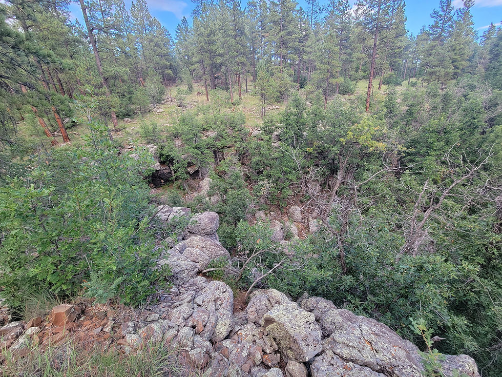


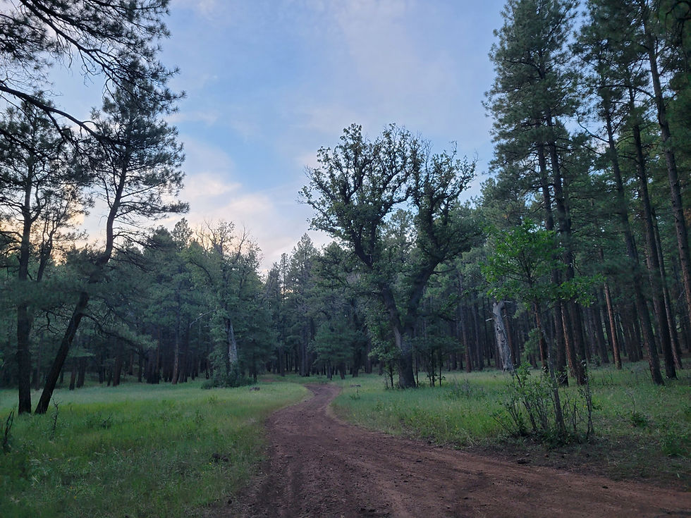




Jacks Canyon along FR 230 in the Coconino National Forest south of Flagstaff is a remote and rewarding dispersed camping destination on the Mogollon Rim — a forested canyon corridor with access to Stoneman Lake, Bill Back Butte, Jackson Butte, spring gauge systems, wild foraging, and miles of canyon hiking through washes, rims, and animal trails in classic high-country Arizona.
Forest

Wildlife

Hiking

OHV

Exploring

14-day stay limit within 30-day period including dispersed sites

Bear Country: Store all food, scented items, and trash in bear boxes where provided. At dispersed sites without bear boxes, store food in a locked vehicle or hung from a tree away from camp.

Cell service may be limited — download maps before you go
Dogs should remain on leash
Fire Restrictions: Check before building any campfire
No Trash Services: Pack it in & Pack it Out
No facilities on site — no water, no restrooms
More Info
Plants Foraged
Banana Yucca

Mullein

Wild Blackberry

Wild Rose (Rose Hips)

Nearby Locations
Montezuma Well

Happy Jack (FR 81)

Jacks Canyon (FR 230)
FR 230 — Rocky Gulch Ridge & Jacks Canyon — runs through the Coconino National Forest south of Flagstaff in the Mogollon Rim Ranger District, threading through a landscape of ponderosa pine, canyon drainages, volcanic buttes, and the kind of remote forest that rewards the people who take the time to explore it properly. We spent four days here September 4–7, 2026 — camping at the fork of FR 230B at 34°44'21.1"N 111°27'05.9"W, hiking Jacks Canyon, foraging rose hips, watching elk pass near camp at dawn, and finding more history and natural detail in this corner of the Coconino than most visitors know exists.
The Drive In — Stoneman Lake, FR 229, FR 300, and FR 230D
We approached via Stoneman Lake Road (FR 213) — making a stop to check out the lake area. From the view beside the lake at the parking area there was no visible water — the lake bed appeared dry from where we stood, with perhaps some moisture remaining at the deepest point suggested only by the vegetation holding on there — possibly a marsh condition rather than open water at this point in the season. Stoneman Lake is a natural sinkhole lake dependent on precipitation and snowmelt for its water level — it likely sees some fill after winter and spring snowmelt returns moisture to the basin. The surrounding cabins dotted the forested shoreline regardless of the lake's current state. Blackberries grew along the lake corridor and we stopped to sample. A gopher snake was chilling among the bushes at the tree line — unbothered and perfectly placed in the late summer vegetation.


From Stoneman Lake we headed back to FR 229 and took it to FR 300 — scouting campsites along the way. Found several with potential and noted them for future reference before continuing on. From FR 300 we turned onto FR 230D and immediately found reasons to stop and explore. A spring gauge system and water tank — we noted its location and condition. Gathered trash left by previous visitors — the standard Leave No Trace practice on forest roads where others haven't bothered.


The Coyote Mint growing in the canyon bottom here was our first encounter with the plant — the fragrance was immediately remarkable. One of the best-smelling plants we have come across in years of Arizona foraging. The canyon bottom along FR 230D concentrates moisture enough to support the kind of riparian plant community that produces these surprises — a reminder that the most interesting foraging often happens along the road rather than at the destination.
We continued scouting camp spots along FR 230B — past Bill Back Butte and Jackson Butte, checking FR 230A where we found one viable spot but chose to continue. The fork of FR 34°44'21.1"N 111°27'05.9"W — scouted in advance on OnX — was exactly what we were looking for. Canyon access on one side, the road toward the buttes on the other, and enough separation from the main FR 230 corridor to feel genuinely remote despite the OHV traffic that moved through on weekend evenings.
The Camp
The site at the fork had access to Jacks Canyon below and a road heading east toward the buttes above. Fire ring constructed from available rock — plenty of firewood to gather in the surrounding forest. The area along FR 230B has a just a few established campsites — most are along FR 230 itself. Our fork site was one of the better dispersed options in the corridor.

Two nights we heard coyotes calling in the darkness — the overlapping calls of multiple animals working the canyon below. Elk called both nights from somewhere in the trees. On two consecutive mornings around 5 AM a herd of elk passed near camp — close enough that Luca got a clear look at them in the early light. The herd had young with them. Two in the back of the group were limping — injured animals moving with the herd. One of those dawn encounters that stays with you.
Saturday morning we woke to camp wet from condensation — the canyon environment at this elevation holding moisture through the night in a way the open desert never does. The mornings were filled with the buzzing of bees working the wildflowers throughout the area — a steady ambient sound that started at first light and continued through the morning.
Before settling in we cleaned the site — the previous visitors had left a significant amount of trash including spent ammunition casings, cans, and glass bottles scattered throughout the area. Among the debris was an old Coors can from the 1970s — the two-hole punch-top style used before pull tabs became standard, a small artifact of the era when this corner of the Coconino was apparently a popular shooting and drinking destination. Cleaned it all out and packed it to the truck. The site was better for it and the work took less time than it sounds.


One afternoon at camp we watched a young tree squirrel working the canopy above us — starting in a section of young trees nearby before moving into the taller ponderosa pines. The sound of its claws grasping the bark was audible from below — a distinct scratching rhythm as it climbed and launched from tree to tree high up in the canopy. The squirrel was fully aware of my presence and made sure I knew it — chattering down at me from the branches with the indignant energy of an animal that considers the forest entirely its own and my presence a personal inconvenience. The kind of small camp entertainment that holds your attention longer than you expect.
Also seen: skunk tracks in the clay mud near camp. An elk skeleton in the wash — the bones scattered but largely intact. A Lowland Leopard Frog (Lithobates yavapaiensis) — found near one of the water features in the area. Arizona's native leopard frog species, recognizable by its green and brown spotted pattern and cream-colored underside. The Lowland Leopard Frog is an Arizona Species of Concern — populations have declined significantly across the state due to habitat loss, drought, and the introduction of non-native predators including bullfrogs and crayfish. Finding one in this spring gauge and tank corridor in the Coconino National Forest is a meaningful sighting — the remaining water in the old tank infrastructure providing exactly the kind of moist microhabitat this species depends on. Worth noting the location for any future reporting to Arizona Game and Fish.


The Canyon Hike — Saturday, 6+ Miles
Our main hike descended into Jacks Canyon — a 6+ mile round trip using the wash, canyon floor, rim, roads, and animal trails in a combination that made route-finding part of the experience. The goal was a large bowl formation we had identified on OnX — an enclosed canyon feature with walls 20+ feet high that looked worth the effort to reach.


We didn't make it to the bowl. A large patch of poison oak across the route was the decision point — we opted not to push through it. Luca continued without the map and didn't locate the bowl independently. The bowl remains on the list for a return trip with a clearer approach route that avoids the poison oak.
What we did find on the hike was worth the distance regardless. In one section of the canyon we came across a cluster of old infrastructure at 34.73332, -111.45958 — several cement tanks, cement blocks with metal brackets, and what appeared to be five or so wells or water collection systems. The purpose and age of the installation was not immediately clear — the cement construction and bracket hardware suggest a mid-20th century water management or ranching operation. This area clearly served some historical function beyond a hiking corridor. Worth researching for a future visit.


The return leg followed the main road for most of the distance — easier footing than the canyon floor but less interesting.
Sunday Evening — The Buttes Hike
Sunday evening we took the road east from camp heading toward the buttes — Bill Back Butte and Jackson Butte. We stopped when we joined up with 230B and found a spot to sit in hopes to see some wildlife, we watched the bats working the air overhead as the light faded — a reliable evening activity in forested canyon country where insects concentrate at dusk and bats follow. Hiked back to camp in the dark.

Foraging — Rose Hips, Coyote Mint, and More
The foraging on this trip was exceptional. Rose hips were picked at camp — fully ripe, red, and abundant on the wild rose plants in the area. Made rose hip tea on site — boiled crushed fresh hips, steeped for 10 minutes, orange-red color, mildly sweet and tangy. See the Wild Rose (Rose Hips) entry in the AZ Places Plant Foraging Guide for the full preparation.
Coyote Mint in the canyon bottom on FR 230D was our first encounter with the plant — the fragrance was extraordinary, the best-smelling plant we have found in years of field foraging across Arizona.
Mullein growing in the island of one of the wash/tank areas on FR 230D was beyond 5 feet tall — among the largest specimens we have seen. Clearly thriving in the disturbed moist soil of the old water management area.


Apache Maid Mountain — Sunday
After breaking camp Sunday we drove toward Apache Maid Mountain. A locked gate near the top prevented us from reaching the lookout tower — the access road gated before the summit. At the gate there is a pull-off that provides views toward the west — Sedona, Cottonwood, Clarkdale, and Jerome all visible across the Verde Valley below, with the Wet Beaver Wilderness spread beneath. A future destination on its own — the Wet Beaver Wilderness below the Apache Maid viewpoint is worth exploring.

On the road to Apache Maid we found Red Barberry — berries a dark purple color, blueberry-like rather than the red the name suggests. Also found a second plant we need to identify — photos taken for later identification.
On our way back down from the Apache Maid viewpoint we spotted a group of six wild turkeys moving through the forest alongside the road — unhurried and unbothered by the truck. A deer seen alongside the road shortly after. A fitting send-off from a mountain that had already delivered Red Barberry, sweeping Verde Valley views, and the promise of the Wet Beaver Wilderness below.

Stoneman Lake Road — Banana Yucca Harvest
On the way out we drove to Stoneman Lake Road near I-17 and harvested Banana Yucca fruit directly from plants along the roadside. See the Banana Yucca entry in the AZ Places Plant Foraging Guide for full harvest and preparation details.
The Drive Home
Labor Day weekend and an accident on I-17 added significant time to the return drive — the standard price of a holiday weekend in the Arizona mountains. Worth noting for future trip planning — leave Sunday rather than Monday if avoiding I-17 Labor Day traffic is a priority.
Spring Gauge Systems — A Note

There are two spring gauge systems in the area — one at the end of FR 230D and another at the end of FR 230C — both appear to be non-operational. Scouted prior to the trip on OnX where the structures were visible on the map, we made the stop at FR 230D (34.73195, -111.46241) on our drive in and the second at FR 230C (34.73199, -111.48465) on our way out — bookending the trip with the same quiet infrastructure mystery on both ends.
At FR 230D one side of the tank and retaining wall had collapsed entirely into the wash bed below — the concrete broken and displaced by the same seasonal water flow the system was built to monitor. At FR 230C The decommissioned building had its door completely detached from the hinges yet still locked — hanging on its side in a state that could only have been achieved through a specific sequence of events worth imagining. Inside the building were signs that something had been living there — the kind of quiet animal occupation that fills a structure the moment humans stop maintaining it. The Mullein growing in the island of the wash and tank area was beyond 5 feet tall — among the largest specimens we have seen. Clearly thriving in the disturbed moist soil of the old water management area.


The spring gauge infrastructure throughout this part of the Coconino appears to be from mid-20th century water monitoring operations — worth noting for anyone interested in the hydrology and historical land management of this corridor. The systems were designed to monitor spring output over time — the data they collected now sits in some archive while the hardware slowly returns to the forest.
More Information
FR 230B and side roads suitable for high clearance vehicles — verify conditions after rain
OHV traffic heavy on weekends — weekday or Thursday arrival recommended
Apache Maid Lookout Tower: road gated near summit — viewpoint pull-off available at gate
⚠️ Poison oak present in lower Jacks Canyon — be aware on canyon hikes
Spring gauge systems on FR 230D — historical water management infrastructure
Rose hips harvestable September through October in this area
Coyote Mint in canyon bottoms along FR 230D
Red Barberry found on Apache Maid approach road
Banana Yucca fruit harvested along Stoneman Lake Road near I-17
#JacksCanyon #FR230 #RockyGulchRidge #CoconinoNationalForest #MogollonRim #DispersedCamping #ArizonaCamping #ElkCountry #ApacheMaid #StonemanLake #AZPlaces #CoconinoCounty #ForestCamping #FreeCamping #ArizonaForaging
Dispersed Camping

Arizona
PGQX+M8H Happy Jack, AZ

Coconino County
34°44'21.1"N 111°27'05.9"W
Elevation: 6,800 feet
Directions
From Flagstaff, AZ:
Head south on I-17 approximately 15 miles to the Stoneman Lake Road exit. Head east on Stoneman Lake Road to the junction with FR 230. Follow FR 230 south — the road runs through the Rocky Gulch Ridge corridor. FR 230B branches off FR 230 and leads in a loop towards Bill Back Butte and Jackson Butte. Our campsite at the fork: 34°44'21.1"N 111°27'05.9"W.
From Phoenix, AZ:
Take I-17 North to the Stoneman Lake Road exit. Follow directions above.


Best Seasons & Temperatures
Late spring through fall is the primary season — FR 230 and the side roads are accessible May through November in dry conditions. September is an excellent visit month — rose hips ripe for harvest, wildflowers active, elk beginning their fall movement, and the forest cooling after summer monsoon season. OHV traffic is heaviest on summer and fall weekends — Labor Day weekend in particular brings significant traffic to the FR 230 corridor. Weekday visits or arriving Thursday ahead of a weekend dramatically improves the solitude. Winter brings snow and potential road closures — verify conditions with the Mogollon Rim Ranger District before visiting outside the May through November window.
Jacks Canyon FR 230 Rocky Gulch Ridge Coconino National Forest dispersed camping canyon hike Arizona Mogollon Rim
September 4–7, 2026