
AtoZ Bucket List
"Where have you been?"


AZ Places
This directory is a history of places we have personally traveled for camping and exploring throughout Arizona, Utah and New Mexico and beyond. Places from the Forests to Deserts with Lakes, Rivers, Hot Springs, Caves and Peaks. Historical and Abandoned places, Ghost Towns and Ancient Runes. Recreation Areas and National & State Parks. Enjoy!

Alamo Lake Wildlife Area


We spend several nights here on the edge of the lake. Enjoyed listening to the water and the birds while siting by the fire. Really great spot for camping. Nice and secluded beaches and peninsulas with beautiful views of the lake and surrounding mountains. A lot of fishermen in boats trolling, lake is well known for bass fishing. Looking forward to return with our kayaks. While in the area we visited the Alamo Dam and made a stop for ice-cream at the ranger store at the Alamo State Park. On our drive there we saw wild burros.
Anasazi Valley Petroglyphs


Explore the fascinating Temi' Po' Op' site, pronounced "tumpee poo oop," located near the Santa Clara River. This family-friendly hike offers breathtaking views and hundreds of petroglyphs. Uncover the remnants of an Anasazi Farmstead and learn about the rich history of this area. Choose between the longer, winding trail or the shorter, well-developed shortcut to access the remarkable rock art that showcases the artistic legacy of various native cultures.
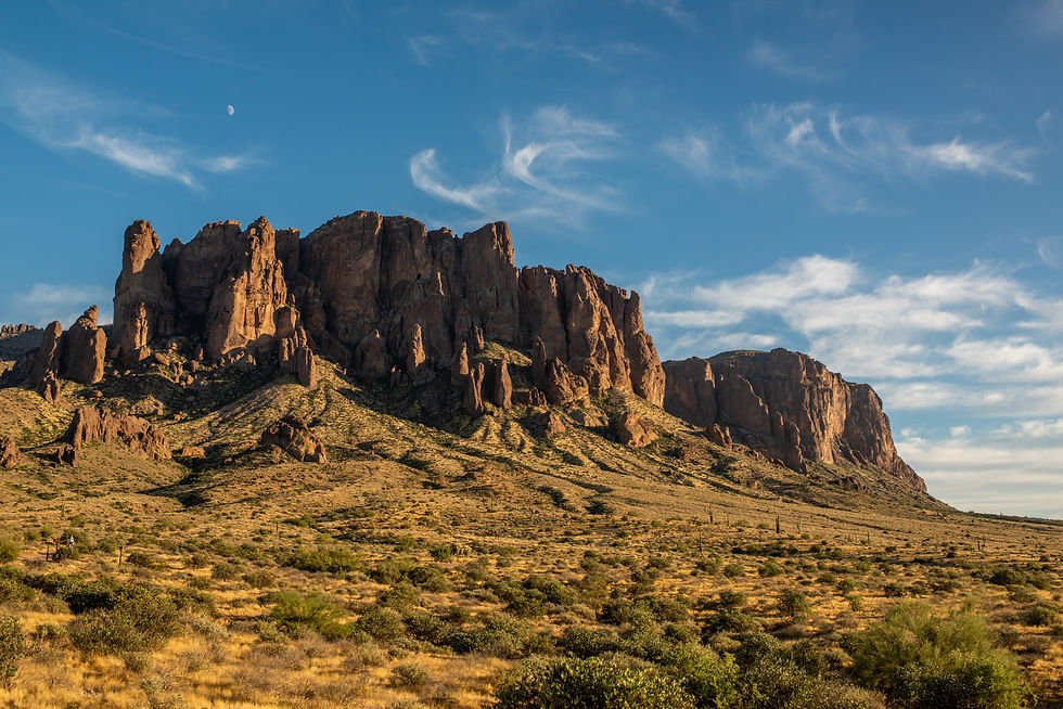
Apache Lake

Apache Lake, located in the Tonto National Forest, is a scenic reservoir offering both developed and dispersed camping options. Surrounded by steep canyon walls and accessible via the historic Apache Trail, it’s a hidden gem perfect for camping, boating, and outdoor adventures. The Burnt Corral Campground provides 76 campsites, and visitors can also enjoy secluded dispersed campsites with stunning views of the lake and desert landscape.
Aztec Ruins National Monument

Aztec Ruins National Monument in New Mexico is home to a complex of ancient ruins built by the ancestral Puebloans over 900 years ago. As I walked through the park, I was struck by the impressive masonry of the structures and the rich history and culture they represent.
Baker Hot Springs

We first visited Baker hot springs in 1995 and went on and off through out the years while I lived in SLC. We last visited while traveling through Utah in 2017, we camped near the springs at that time there was one other camper. This gentlemen served us pancakes in the morning and told us he had spotted a white llama that came down from the hill to drink from the water. During our visit the water was flowing well and appeared the tubs have been well maintained, due to lack of algae. We found an additional pool in the area that could be dipped in as well as the tubs. There was once some abandoned buildings in the area, they since I believe have been destroyed. I look forward to visiting Baker hot springs again.
Bear Canyon Lake

Bear Canyon Lake is one place we go most often. There are plenty of places to setup camp and lots to explore. We have never had a issue finding a spot to camp, at times can barely hear anyone around. We pass all the nearest sites near the lake and go past the powerlines where there are plenty of sites spread out. From there it is a bit of a hike to the lake, or short drive. Depending upon the season you can hear elk and coyotes in the area.

Blue Ridge Reservoir


Camping near C.C. Cragin Reservoir offers a unique escape into nature, where you can enjoy peaceful solitude surrounded by rugged canyon walls, serene waters ideal for kayaking, and the thrill of fishing for rainbow trout, all while being immersed in the diverse wildlife and scenic beauty of the area.

Bradshaw City Ghost Town

Explore the historic ruins of Bradshaw City, a former gold-mining boomtown established in 1863 in Yavapai County, Arizona. Once home to nearly 5,000 residents, today it offers visitors a fascinating glimpse into Arizona's mining past, surrounded by beautiful forested landscapes.
Casa Grande Domes

The Domes of Casa Grande was four massive structures located in Casa Grande, Arizona, that were built to facilitate the manufacturing of computers in the late 1970s and early 1980s. However, the project was never completed, leaving behind only a few foundations that were started and left to molder. One of the buildings is shaped like a flying saucer, and the other three resemble spheres joined together. Despite their abandoned state, the Domes remain a popular destination for urban explorers and photographers, drawing visitors to their otherworldly appearance.
Chaco Culture National Historical Park

This Chaco Canyon Valley, high-desert landscape has long winters, short growing seasons, and marginal rainfall. Yet, it became the center of a thriving culture a thousand years ago. It was an unlikely place for a major center of ancestral Puebloan culture to take root and flourish. The grand scale of its architecture is monumental, making it a center hub for far-reaching commerce with complex community life and high levels of social organization, creating a cultural vision unlike any other seen before or since. That began in the mid 800s and lasted more than 300 years. Their descendants are the modern Southwest Indians. Many Southwest Indian people look upon Chaco as an important stop along their clans' sacred migration paths-a spiritual place to be honored and respected.
