

AtoZ Bucket List
"Where have you been?"
Abandoned & Ghost Towns
Caves
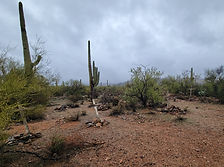
Desert
Forest
Historical & Ancient Ruins
Hot Springs
Lakes & Rivers
National & State Parks
Peaks

Abandoned & Ghost Towns
Arizona's boom-and-bust history left behind trading posts, mining towns, homesteads, and roadside relics slowly being reclaimed by the desert. These are places that once thrived — some for decades, some for just a few years — before the ore ran out, the railroad moved on, or the money dried up. What remains ranges from crumbling foundations to standing walls and rusted equipment that looks like it was abandoned last week.

Anasazi Inn & Painted Desert Project


The abandoned Anasazi Inn at Gray Mountain, Arizona has been transformed by the Painted Desert Project into a striking outdoor mural gallery — large-scale street art and wheat-paste photography covering the weathered walls of a forgotten roadside motel along Highway 89 on the Navajo Nation.
#Abandoned, #Desert, #Exploring, #Historical, #NavajoNation, #Photography
Bradshaw City Ghost Town


Explore the historic ruins of Bradshaw City, a former gold-mining boomtown established in 1863 in Yavapai County, Arizona. Once home to nearly 5,000 residents, today it offers visitors a fascinating glimpse into Arizona's mining past, surrounded by beautiful forested landscapes.
#Camping, #GhostTown, #Forest
Casa Grande Domes

The Domes of Casa Grande was four massive structures located in Casa Grande, Arizona, that were built to facilitate the manufacturing of computers in the late 1970s and early 1980s. However, the project was never completed, leaving behind only a few foundations that were started and left to molder. One of the buildings is shaped like a flying saucer, and the other three resemble spheres joined together. Despite their abandoned state, the Domes remain a popular destination for urban explorers and photographers, drawing visitors to their otherworldly appearance.
#Abandoned, #Desert
Courtland Ghost Town

Nestled in an arid landscape, Courtland, born from early 1900s mining fervor, whispers tales of a once-thriving community. A fading jail, a collapsing store, and silent foundations stand as echoes of its past. The hills, marked by mines, caution visitors of the hidden hazards within the remnants of Courtland's mining legacy.
#GhostTown, #Historical, #Exploring, #Desert, #Wildlife
Gleeson Ghost Town

Gleeson Ghost Town is one of southeastern Arizona's most atmospheric abandoned mining communities — featuring the ruins of a hospital, saloon, school foundation, and a restored 1910 concrete jail turned museum, set against the dramatic backdrop of the Dragoon Mountains.
#GhostTown, #Historical, #Exploring, #Wildlife, #Desert
Ironwood Forest National Monument


Ironwood Forest National Monument is a protected area located in southern Arizona, United States. It was established in 2000 and covers approximately 129,000 acres of Sonoran Desert landscape. The monument is named after the iconic ironwood trees (Olneya tesota) that grow within its boundaries.
#BLM, #Camping, #RockHounding, #Ancient Ruins, #Petroglyphs, #Desert, #NationalMonument, #Recreation, #Historical
Organ Pipe Cactus National Monument

Explore the rugged beauty of Organ Pipe Cactus National Monument, a UNESCO biosphere reserve where vast desert landscapes meet striking mountain ranges. Discover rare flora, hike scenic trails, and experience the vibrant biodiversity of Arizona’s Sonoran Desert.
#Hiking, #Camping, #SonoranDesert, #NationalMonument, #GhostTown, #Cave, #Recreation, #Desert
Ruby Ghost Town

Just a day trip away from Tucson & 4 miles shy of the border of Mexico is a rare opportunity to look back at over a century of Arizona's mining history. From a once-thriving community of 1,200 people to a modern-day ghost town. Ruby has access to over 350 acres of trails, two lakes, and incredible biodiversity.
#Desert, #GhostTown
Sasco Ghost Town

Sasco Ghost Town near Red Rock, Arizona is the crumbling remains of a Southern Arizona copper smelting operation from the early 1900s — featuring the ruins of the Rockland Hotel, smelter foundations, and a fascinating piece of Arizona mining history off the beaten path.
#Abandoned
Silver Bell Cemetery

Silver Bell Cemetery is a historic frontier graveyard tucked inside the Ironwood Forest National Monument near Marana, Arizona — the last visible remnant of the original Silverbell mining community that boomed and went bust in the early 1900s.
#Abandoned, #Historical, #Exploring, #BLM
Silver Reef Ghost Town


Explore Silver Reef Ghost Town near Leeds, Utah, a once-thriving mining town uniquely built on silver-bearing sandstone. Founded in 1875 and abandoned by 1891, this historical gem offers a fascinating glimpse into the Wild West's mining past, scenic views, and family-friendly activities.
#GhostTown, #Abandoned, #Historical, #Camping, #Recreation, #Desert
Titan II Missile Interpretive Site

The Titan II Missile Interpretive Site inside the Ironwood Forest National Monument near Marana, Arizona is one of 18 former nuclear missile launch sites that once ringed Tucson during the Cold War — a decommissioned silo where a 9-megaton warhead sat on 58-second launch readiness for over 20 years, now open to the public as a free interpretive site.
Twin Arrows Trading Post

Twin Arrows Trading Post a Route 66 roadside attraction was built in the late 1940's and was abandoned in 1995. It consists of giant yellow wooden twin arrows, an abandoned gift shop and Valentine’s diner, some gas pumps, and big tanks in the back still remain. The building and various structures are deteriorating, this Icon has certainly seen better days. From what I understand the land is owned by the Twin Arrows Navajo Casino, that appears have yet to cleanup the area. Now abandoned buildings and structures have become a canvas for graffiti artists. Lots of interesting and creative graffiti to explore.
#Historical, #Abandoned, #Desert
Two Guns

Two Guns is one of Arizona's most haunted and storied Route 66 ghost towns — a cursed stretch of Canyon Diablo where a Navajo massacre, a Wild West showman, a mountain lion zoo, a murder, and a devastating fire all converged on the same dusty patch of high desert east of Flagstaff.
#Historical, #Abandoned, #Desert
See a tent?

Place has camping
or close by.
Abandoned & Ghost Towns
Caves
Desert
Forest
Historical & Ancient Ruins
Hot Springs
Lakes & Rivers
National & State Parks
Peaks