

AtoZ Bucket List
"Where have you been?"
Abandoned & Ghost Towns
Caves
Desert
Forest
Historical & Ancient Ruins
Hot Springs
Lakes & Rivers
National & State Parks
Peaks

Historical & Ancient Ruins
History in Arizona isn't just in textbooks — it's in the ruins, the old roads, the mine shafts, and the homestead foundations scattered across the land. From Cold War missile silos to ancient Native American sites, these places connect the present to something bigger. We believe in seeing history firsthand whenever possible.

Anasazi Ridge Petroglyphs


The Temi' Po' Op' petroglyph site near Ivins, Utah offers a family-friendly 2.9-mile hike along the Santa Clara River to hundreds of ancient rock art panels, an Anasazi farmstead foundation, and sweeping views of the red rock canyon — one of the highest concentrations of petroglyphs in southern Utah.
#Ancient Ruins, #Petroglyphs, #Historical, #Hiking, #Desert
Aztec Ruins National Monument


Aztec Ruins National Monument in New Mexico is home to a complex of ancient ruins built by the ancestral Puebloans over 900 years ago. As I walked through the park, I was struck by the impressive masonry of the structures and the rich history and culture they represent.
#Ancient Ruins, #Historical, #NationalMonument
Chaco Culture National Historical Park


This Chaco Canyon Valley, high-desert landscape has long winters, short growing seasons, and marginal rainfall. Yet, it became the center of a thriving culture a thousand years ago. It was an unlikely place for a major center of ancestral Puebloan culture to take root and flourish. The grand scale of its architecture is monumental, making it a center hub for far-reaching commerce with complex community life and high levels of social organization, creating a cultural vision unlike any other seen before or since. That began in the mid 800s and lasted more than 300 years. Their descendants are the modern Southwest Indians. Many Southwest Indian people look upon Chaco as an important stop along their clans' sacred migration paths-a spiritual place to be honored and respected.
#Ancient Ruins, #Camping, #Hiking, #Historical, #Petroglyphs, #NationalPark
Chiricahua National Monument


Chiricahua National Monument in southeastern Arizona preserves one of the most spectacular volcanic rock landscapes in North America — 27 million years of erosion have carved towering rhyolite pinnacles, balanced rocks, and soaring spires from the Chiricahua Mountains, explored via 17 miles of hiking trails and an 8-mile scenic drive to Massai Point.
#Ancient Ruins, #Camping, #Hiking, #Historical, #NationalMonument, #Wildlife, #Photography, #Exploring, #Desert
Colossal Cave Mountain Park

Colossal Cave Mountain Park has cave tours, hiking & biking, trail rides, camping & picnicking, terrace Café & gift shop. The campsites are tucked among the saguaro cacti and mesquite trees in Posta Quemada canyon. These grounds consist of two large areas, El Bosquecito and La Selvilla, both have water and restrooms. Additionally there are a number of smaller areas totaling 30 individual sites. Camping is first-come, first-served. This is primitive camping. No electricity or RV hook-ups available. are located in El Bosquecito and La Selvilla.
#Camping, #Cave, #Historical, #Hiking, #Recreation, #Desert
Navajo National Monument

Navajo National Monument in northern Arizona preserves three of the most intact Ancestral Puebloan cliff dwellings in the Southwest — Betatakin, Keet Seel, and Inscription House — set within the dramatic Tsegi Canyon system on the Navajo Nation, with free entry, free camping, and ranger-led tours to dwellings last occupied around 1300 AD.
Palatki Heritage Site

Palatki Heritage Site is one of the largest and best-preserved Sinagua cliff dwelling complexes near Sedona, Arizona — featuring ancient rock art, pictographs up to 6,000 years old, and guided tours through red sandstone alcoves in the Coconino National Forest.
#Ancient Ruins, #Petroglyphs, #CoconinoNationalForest
Picacho Peak State Park


Picacho Peak State Park, located along Arizona's I-10 corridor, is a stunning desert destination known for its striking peak, hiking trails, and rich history. A favorite for outdoor enthusiasts, the park offers camping, wildlife watching, and breathtaking desert views.
#Camping, #Hiking, #ArizonaStateParks, #SonoranDesert, #Desert, #Historical
Saddle Mountain

Discover Saddle Mountain in Tonopah, Arizona, a hidden gem for rock hounds, hikers, and outdoor enthusiasts. This stunning desert landscape offers chalcedony and quartz hunting, vibrant sunsets, petroglyph exploration—perfect for a unique desert adventure.
#Hiking, #SonoranDesert, #Camping, #Recreation, #Petroglyphs, #RockHounding
Sears Kay Ruins

Sears Kay Ruins is an ancient Hohokam fortification in the Tonto National Forest near Carefree, Arizona — listed on the National Register of Historic Places and accessible via a short self-guided loop trail with sweeping desert views.
#Ancient Ruins, #Exploring, #Hiking, #Historical, #TontoNationalForest
Shoofly Village Ruins

Shoofly Village Ruins near Payson, Arizona is one of the most accessible ancient archaeological sites on the Mogollon Rim — a 4-acre prehistoric compound with 80+ rooms, a surrounding stone wall, and interpretive signs that bring a 1,000-year-old community back to life.
#Ancient Ruins, #Exploring, #Desert, #Hiking, #Historical, #TontoNationalForest
Silver Bell Cemetery

Silver Bell Cemetery is a historic frontier graveyard tucked inside the Ironwood Forest National Monument near Marana, Arizona — the last visible remnant of the original Silverbell mining community that boomed and went bust in the early 1900s.
#Abandoned, #Historical, #Exploring, #BLM
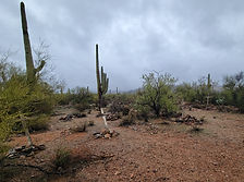
Titan II Missile Interpretive Site

The Titan II Missile Interpretive Site inside the Ironwood Forest National Monument near Marana, Arizona is one of 18 former nuclear missile launch sites that once ringed Tucson during the Cold War — a decommissioned silo where a 9-megaton warhead sat on 58-second launch readiness for over 20 years, now open to the public as a free interpretive site.
Tonto National Monument

The Salado Phenomena, 700 years ago, blended ideas of neighboring Native American cultures to emerge a unique and vibrant society. Tonto National Monument showcases two Salado-style cliff dwellings. Colorful pottery, woven cotton cloth, and other artifacts tell a story of people living and using resources from the northern Sonoran Desert from 1250 to 1450 CE.
#Hiking, #NationalMonument
Topaz Internment Camp & Museum

Topaz Internment Camp near Delta, Utah is the site of one of the largest WWII Japanese American internment camps — where nearly 8,000 American citizens were confined from 1942 to 1945. A small museum in Delta preserves their story.
#Historical
Two Guns

Two Guns is one of Arizona's most haunted and storied Route 66 ghost towns — a cursed stretch of Canyon Diablo where a Navajo massacre, a Wild West showman, a mountain lion zoo, a murder, and a devastating fire all converged on the same dusty patch of high desert east of Flagstaff.
#Historical, #Abandoned, #Desert
Walnut Canyon National Monument

Discover the awe-inspiring Walnut Canyon National Monument near Flagstaff, Arizona, where ancient cliff dwellings and breathtaking canyon vistas invite you to step back in time. Hike along scenic trails, spot unique wildlife, and immerse yourself in the rich cultural and natural history of this remarkable destination.
#Ancient Ruins, #Historical, #Hiking, #NationalMonument
See a tent?

Place has camping
or close by.
Abandoned & Ghost Towns
Caves
Desert
Forest
Historical & Ancient Ruins
Hot Springs
Lakes & Rivers
National & State Parks
Peaks