

AtoZ Bucket List
"Where have you been?"

Featured Video

AZ Places
This is our personal record of places explored — not a curated list from a travel site, but real trips, real roads, and real firsthand experience. Forests, deserts, lakes, rivers, hot springs, caves, peaks, ghost towns, ancient ruins, and more. Arizona, Utah, New Mexico, and beyond. Go find your next one.


Abandoned & Ghost Towns

Ancient Ruins

Caves

Desert

Forest

Historical

Hot Springs

Lakes & Rivers

National & State Parks

Peaks
Pinal Mountains
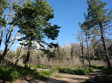


The Pinal Mountains rise to 7,848 feet just south of Globe, Arizona — a sky island of ponderosa pine and white fir tucked inside the Tonto National Forest, offering cool summer camping, eight hiking trails, sweeping views from the lookout tower and some of the most surprising wildlife encounters in central Arizona.
#Forest, #Camping, #Recreation, #Hiking, #Historical, #Wildlife, #Exploring, #Photography
Pinery Creek

Pinery Creek dispersed camping on FR 42C near Onion Saddle in the Chiricahua Mountains offers one of the most rewarding off-the-beaten-path camp experiences in southeastern Arizona — cliff views at 6,160 feet, a cold clear creek for swimming, an Acorn Woodpecker granary tree right in camp, and the kind of solitude that only comes from finding a place most people drive past.
#Camping, #Cave, #Exploring, #Forest, #Hiking, #Photography, #Recreation, #Wildlife
Red Cliffs Recreation Area
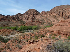

Red Cliffs Recreation Area near Leeds, Utah is a BLM gem tucked against dramatic red sandstone cliffs just off I-15 — featuring Early Jurassic dinosaur tracks in the sandstone, Ancestral Puebloan ruins, 14 hiking trails through Quail Creek Canyon, and one of the most visually striking campgrounds in southern Utah.
#Camping, #Hiking, #Recreation
Red Rock State Park


Red Rock State Park is Sedona's most serene and family-friendly outdoor destination — a 286-acre nature preserve along Oak Creek where five miles of interconnected trails wind through manzanita and juniper to the creek's lush riparian corridor, framed by the iconic red rock formations that make Sedona famous worldwide.
#ArizonaStateParks, #Desert, #Hiking, #River, #Wildlife, #Photography
Riggs Flat Lake

Riggs Flat Lake is an 11-acre alpine lake at 9,000 feet near the summit of Mount Graham in the Coronado National Forest — stocked with rainbow, brown, and brook trout, surrounded by pine forest and meadow, and sitting at the end of the Swift Trail as a reward for the drive up.
#Camping, #Boating, #Fishing, #Exploring, #Forest, #Hiking, #Lake, #Wildlife, #Photography
Robbers Roost — Hideout Cave


Robbers Roost Trail near Sedona leads to a historic outlaw hideout cave in the red rock country of the Coconino National Forest — a rocky trail through classic Arizona high desert to a cave with framed views of Sedona's red rock cliffs, a dozen or more deer grazing in the canyon below, and dispersed camping available along the adjacent FR 258 Buckboard Road for those looking to stay.
#Cave, #Exploring, #Desert, #CoconinoNationalForest, #Hiking, #Historical, #Photography, #Views, #Wildlife
Roosevelt Lake

Roosevelt Lake is Arizona's largest lake entirely within state borders — a 21,000-acre desert reservoir formed by the historic Theodore Roosevelt Dam on the Salt River, offering world-class bass fishing, kayaking, lakeside camping, and sweeping Sonoran Desert views just 90 miles from Phoenix.
#Boating, #Camping, #Desert, #Fishing, #Hiking, #Lake, #Recreation, #Wildlife
Ruby Ghost Town
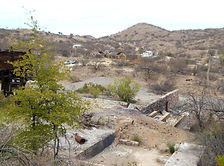
Just a day trip away from Tucson & 4 miles shy of the border of Mexico is a rare opportunity to look back at over a century of Arizona's mining history. From a once-thriving community of 1,200 people to a modern-day ghost town. Ruby has access to over 350 acres of trails, two lakes, and incredible biodiversity.
#Desert, #GhostTown
Saddle Mountain
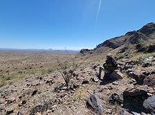

Saddle Mountain near Tonopah, Arizona is one of the Phoenix area's most rewarding BLM dispersed camping destinations — a volcanic mountain range at 2,600 feet in the western Sonoran Desert where rockhounds find chalcedony, fire agate, and quartz crystals on the desert floor, ancient petroglyphs mark the volcanic slopes, spectacular sunsets paint the sky, and javelina, jackrabbit, and ocotillo in bloom complete a classic desert spring experience within an hour of the Valley.
#Hiking, #SonoranDesert, #Camping, #Recreation, #Petroglyphs, #RockHounding
Saguaro National Park East

Saguaro National Park East — the Rincon Mountain District — protects one of the densest saguaro forests on earth alongside the 8-mile Cactus Forest Drive, 128 miles of hiking trails, and a wilderness backcountry that climbs from Sonoran Desert to pine forest at 8,666 feet in the Mica Mountains.
#Desert, #Historical, #NationalPark, #Hiking
Sand Island Petroglyphs

Sand Island Petroglyphs near Bluff, Utah preserves over 100 yards of continuous rock art panel on the banks of the San Juan River — spanning 2,500 to 8,000 years of human history from Archaic hunters to Ancestral Puebloans, Ute, and Navajo peoples, including five Kokopelli figures, San Juan Anthropomorphs, and some of the most accessible ancient rock art in the Bears Ears National Monument region.
#Petroglyphs, #BLM, #Camping, #Desert, #Exploring, #Historical, #Photography
Sasco Ghost Town

Sasco Ghost Town near Red Rock, Arizona is the crumbling remains of a Southern Arizona copper smelting operation from the early 1900s — featuring the ruins of the Rockland Hotel, smelter foundations, and a fascinating piece of Arizona mining history off the beaten path.
#Abandoned

Arizona
Abandoned & Ghost Towns
Ancient Ruins
Caves
Desert
Forest
Historical
Hot Springs
Lakes & Rivers
National & State Parks

Peaks