

AtoZ Bucket List
Where have you been?

AZ Places

Peaks

Abandoned & Ghost Towns

Ancient Ruins

Caves

Desert

Forest

Historical

Hot Springs

Lakes & Rivers

National & State Parks
AZ Places
This is our personal record of places explored — not a curated list from a travel site, but real trips, real roads, and real firsthand experience. Forests, deserts, lakes, rivers, hot springs, caves, peaks, ghost towns, ancient ruins, and more. Arizona, Utah, New Mexico, and beyond. Go find your next one.
FILTER
11

Places with camping
Filter
No locations found matching your search. Try adjusting your filters.
Alamo Lake Wildlife Area


Alamo Lake Wildlife Area near Wenden, Arizona is a remote desert oasis where the Bill Williams River spreads into a 3,500-acre bass fishing lake surrounded by saguaro-covered mountains — with dispersed camping on secluded beaches and peninsulas, exceptional birdwatching year-round, and wild burros roaming the desert road in.

Anasazi Inn & Painted Desert Project


The abandoned Anasazi Inn at Gray Mountain, Arizona has been transformed by the Painted Desert Project into a striking outdoor mural gallery — large-scale street art and wheat-paste photography covering the weathered walls of a forgotten roadside motel along Highway 89 on the Navajo Nation.
Anasazi Ridge Petroglyphs


The Temi' Po' Op' petroglyph site near Ivins, Utah offers a family-friendly 2.9-mile hike along the Santa Clara River to hundreds of ancient rock art panels, an Anasazi farmstead foundation, and sweeping views of the red rock canyon — one of the highest concentrations of petroglyphs in southern Utah.
Apache Lake


Apache Lake, located in the Tonto National Forest, is a scenic reservoir offering both developed and dispersed camping options. Surrounded by steep canyon walls and accessible via the historic Apache Trail, it’s a hidden gem perfect for camping, boating, and outdoor adventures. The Burnt Corral Campground provides 76 campsites, and visitors can also enjoy secluded dispersed campsites with stunning views of the lake and desert landscape.
Apache Trail (Davis Wash)

Davis Wash along the Apache Trail (AZ-88) near Apache Lake in the Tonto National Forest is one of the most scenic and accessible dispersed camping areas in the greater Phoenix area — a rugged desert canyon setting at the edge of Apache Lake with wildflowers, Sonoran Desert wildlife, lake views from the hilltops, and the kind of close-to-Phoenix solitude that's increasingly hard to find.
Aztec Ruins National Monument


Aztec Ruins National Monument in Aztec, New Mexico preserves one of the best-preserved Ancestral Puebloan great house complexes in the American Southwest — a UNESCO World Heritage Site featuring the West Ruin's 400+ interconnected rooms, original wooden ceiling beams, and the largest reconstructed Great Kiva in North America, walkable on a self-guided tour through rooms built in the 1100s.
Baker Hot Springs

Baker Hot Springs — also known as Crater Springs and Abraham Hot Springs — is one of Utah's most accessible and enduringly popular free hot springs, a chain of geothermal tubs fed by 180°F source water on Fumarole Butte northwest of Delta in Juab County, with three concrete soaking pools, dispersed camping nearby, and the kind of remote high desert setting that has been drawing visitors for well over a century.
Battle of the Bulls Monument

The Battle of the Bulls Monument on the San Pedro River near Sierra Vista, Arizona marks the only combat engagement of the Mormon Battalion during its remarkable 2,000-mile march from Iowa to San Diego in 1846 — a chaotic confrontation with a stampeding herd of wild bulls at The Narrows that left three men wounded, three mules gored, and at least nine bulls dead, commemorated by a stone marker erected by Boy Scout Troop 21 in 1960.
Bear Canyon Lake


Bear Canyon Lake is one of the most rewarding dispersed camping destinations on the Mogollon Rim — a beautiful, narrow, canyon-bound lake at 7,560 feet in the Apache-Sitgreaves National Forest, stocked with rainbow trout six times a year, surrounded by mixed conifer and aspen, and tucked far enough off the main road that solitude is almost always guaranteed.
Bear Flat (FR 405)

Bear Flat is one of the Tonto National Forest's most rewarding and least-visited dispersed camping areas — easy forest road access through the pines near Payson, Arizona, with an old homestead site, a spring-fed canyon trail, wild blackberries and bear country solitude on FR 405 and 405A. Tonto Creek is a short drive away with access to a trail leading to the rugged Hellsgate Wilderness.
Bear Springs | Sunny Park (FR 124)

Discover the beauty of Arizona along Forest Road 124 in the Apache-Sitgreaves National Forest. This scenic destination features rugged forest terrain, towering ponderosa pines, and open meadows dotted with vibrant wild mushrooms. Visitors can also witness burn scars from the historic Rodeo-Chediski Fire, now blending with vibrant new growth—a powerful testament to nature's resilience. Wildlife you may encounter include wild horses, jackrabbits, deer, foxes, and squirrels.
Black Canyon (FR 300)

Black Canyon Rim Road (FR 300) in the Apache-Sitgreaves National Forest is a ponderosa pine forest corridor at 7,060 feet on the Mogollon Rim — home to wild horses at Black Canyon Lake, the historic Stott, Scott and Wilson gravesite from the Pleasant Valley War, Gentry Lookout Tower views across the rim, dispersed camping, and the General Crook Trail through one of the quietest and most rewarding corners of northeastern Arizona.
Black Canyon Lake

Black Canyon Lake is a scenic 78-acre trout fishing lake on the Mogollon Rim in the Apache-Sitgreaves National Forest — a quiet alternative to the more visited Rim Lakes, with forested shoreline, electric motor boating, and wild horses known to stop at the water's edge.
Black River (Fork Confluence)

The confluence of the East Fork and West Fork Black River in the Apache-Sitgreaves National Forest is one of Arizona's most rewarding dispersed camping destinations — reached via the short but rough Home Creek Road (FR 8750), with trout fishing, a spillway swimming hole, and genuine high-country solitude at nearly 7,500 feet.
Black River (West Fork)

The West Fork of the Black River along FR 68 in the Apache-Sitgreaves National Forest is one of Arizona's most rewarding high-elevation dispersed camping destinations — a clear mountain river at 7,740 feet surrounded by towering ponderosa pine, wild horses, abundant wildlife, and a short hike to Colonel Spring for fresh cold water, in the heart of White Mountains country that bears the scars and recovery of Arizona's largest wildfire.
Boyce Thompson Arboretum

Boyce Thompson Arboretum near Superior, Arizona is the oldest and largest botanical garden in Arizona — a 392-acre living museum of over 12,000 arid-land plants from the deserts of the world, set along Queen Creek at the foot of Picket Post Mountain, with five miles of trails, the historic Clevenger House herb garden, world-class birding, and three nationally accredited plant collections.
Bradshaw City Ghost Town

Bradshaw City is one of Arizona's most rewarding and least-visited ghost towns — a former gold-mining boomtown established in 1863 in the Bradshaw Mountains of the Prescott National Forest, once home to nearly 5,000 residents, now a dispersed camping destination where stone foundations, collapsed homesteads, springs, and a wooden mining structure survive in the ponderosa pine forest at 6,358 feet above Yavapai County.
C.C. Cragin Reservoir

C.C. Cragin Reservoir — more commonly known as Blue Ridge Reservoir — is one of the most distinctive high-country lakes in Arizona, a narrow canyon-bound reservoir near Happy Jack that looks more like a river than a lake, fed by three watersheds at 6,700 feet, stocked with rainbow, brown, and tiger trout, and surrounded by the ponderosa pine forest of the Mogollon Rim Ranger District in the Coconino National Forest.
Canyon Lake
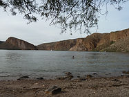
Canyon Lake is the most scenic of Arizona's four Salt River reservoirs — a 950-acre lake tucked into the winding canyon walls of the Apache Trail with 28 miles of shoreline, 1,300-foot volcanic cliffs, hidden coves accessible only by water, and the famous Dolly Steamboat narrated cruise where bald eagles, bighorn sheep, and peregrine falcons are regular sightings in the shadow of the Superstition Mountains.
Casa Grande Domes

The Casa Grande Domes were four massive concrete structures off I-8 in Casa Grande, Arizona — built in the late 1970s as a computer manufacturing facility that was never completed, abandoned for decades, covered in generations of graffiti, and demolished in 2023. Two visits across seven years documented the domes in progressive deterioration — from damaged but standing to structurally collapsing — before the site was cleared entirely.
Casa Grande Ruins National Monument

Casa Grande Ruins National Monument in Coolidge, Arizona preserves the largest known prehistoric structure in North America — a four-story Hohokam adobe Great House built around 1350 CE, protected by a massive steel canopy, designated as America's first archaeological reserve in 1892, and surrounded by the remnants of a sophisticated farming civilization that irrigated the Sonoran Desert for over a thousand years.
Chaco Culture National Historical Park

Chaco Culture National Historical Park in northwestern New Mexico is one of the most significant and least visited archaeological sites in North America — a UNESCO World Heritage Site preserving thirteen major Ancestral Puebloan great houses built between 850 and 1250 CE in a remote canyon that served as the ceremonial, economic, and astronomical center of a civilization spanning 50,000 square miles of the Colorado Plateau.
Chevelon Canyon Lake

Chevelon Canyon Lake, nestled on the Mogollon Rim in northern Arizona, is a serene, hidden gem offering fishing, hiking, and camping. Accessible via a challenging hike, this narrow reservoir is surrounded by rugged canyon views, perfect for nature lovers seeking adventure.
Chiricahua Mountains

Cave Creek Canyon in the Chiricahua Mountains near Portal, Arizona is one of the most biologically diverse canyons in North America — a birding mecca with 370+ species, spectacular rhyolite cliffs, year-round flowing streams, multiple campgrounds, waterfalls, and dispersed camping across one of Arizona's most rewarding sky island ranges.
Chiricahua National Monument

Chiricahua National Monument in southeastern Arizona preserves one of the most spectacular volcanic rock landscapes in North America — 27 million years of erosion have carved towering rhyolite pinnacles, balanced rocks, and soaring spires from the Chiricahua Mountains, explored via 17 miles of hiking trails and an 8-mile scenic drive to Massai Point.

Cliff Dwellers Stone House

Cliff Dwellers Stone House along Highway 89A in Marble Canyon, Arizona is one of the most unusual roadside stops in the Southwest — a series of stone rooms and outbuildings built directly beneath and between massive balancing boulders in the 1930s by a former Ziegfeld Follies dancer whose car broke down in the desert and decided to stay, now sitting open and free to explore within Vermilion Cliffs National Monument.
Colossal Cave Mountain Park

Colossal Cave Mountain Park near Vail, Arizona offers cave tours, hiking and biking trails, horseback riding, camping, and picnicking across a 2,400-acre historic park featuring the crystal-filled Colossal Cave and the 120-year-old La Posta Quemada Ranch. Campsites are tucked among saguaro cacti and mesquite trees in Posta Quemada Canyon — 30 primitive sites across El Bosquecito and La Selvilla, both with water and restrooms. First-come first-served, $15/night. No electricity or RV hookups.
Courtland Ghost Town

Courtland Ghost Town at the foot of the Dragoon Mountains near Tombstone, Arizona is one of the most atmospheric and least visited ghost towns in Cochise County — a copper boomtown that rose from nothing in 1909 to a population of 2,000 in under a decade, then collapsed just as quickly when the mines hit limestone, leaving behind a deteriorating jail, scattered foundations, old sidewalks, mine shafts, and a turquoise mining heritage that stretches back to the Hohokam and Apache long before any American set foot in the Dragoon Mountains.
Dead Horse Ranch State Park

Dead Horse Ranch State Park in Cottonwood, Arizona is a 423-acre Verde River riparian paradise — home to one of fewer than 20 Fremont Cottonwood-Goodding Willow forests remaining worldwide, three stocked fishing lagoons, 20+ miles of trails, kayaking on the Verde River, and camping under the cottonwoods in the heart of the Verde Valley.
Dos Cabezas Pioneer Cemetery

Dos Cabezas Pioneer Cemetery is a hillside frontier graveyard in the ghost town of Dos Cabezas near Willcox, Arizona — the final resting place of approximately 180 pioneers, miners, ranchers, and families from the 1870s onward, with many unmarked graves and a plaque honoring those whose names are known but locations are not.
Edge of the World (FR 231)

Edge of the World — known officially as East Pocket — is one of the most dramatic free dispersed camping destinations in Arizona, perched at nearly 8,000 feet on the rim of the Mogollon Rim escarpment in the Coconino National Forest with sweeping views of Sedona's Red Rock-Secret Mountain Wilderness, Cottonwood, and Mingus Mountain stretching across the Verde Valley far below.
Fish Creek Canyon Wilderness (The Twist)

Fish Creek Canyon Wilderness Study Area on Cedar Mesa in San Juan County, Utah is one of the most remote and rewarding backcountry destinations in the Bears Ears region — deep canyons reaching 700 feet, natural arches, Ancestral Puebloan ruins, and the historic Emigrant Trail route followed by Mormon pioneers in 1879, accessed via the rugged Snow Flat Road (BLM 237) through some of the most spectacular canyon country in the Southwest.
Fort Verde State Historic Park
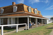
Fort Verde State Historic Park in Camp Verde is the best-preserved example of an American Indian Wars period fort in Arizona — a 12-acre state park preserving the original 1870s administration building and three officers' row houses, all furnished in period style, with museum exhibits covering General Crook's campaigns, the Buffalo Soldiers, US Army Signal Corps, and the scouts and soldiers who served in the Verde Valley from 1865 to 1891.
Fossil Creek Wild and Scenic River
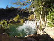
Fossil Creek is one of only two Wild and Scenic Rivers in Arizona — a spring-fed desert oasis discharging over 30 million gallons of 72°F water daily from the base of the Mogollon Rim, with crystal-clear turquoise pools, travertine waterfalls, lush riparian habitat, and one of the most dramatic creek restoration stories in the American Southwest.
Gleeson Ghost Town

Gleeson Ghost Town is one of southeastern Arizona's most atmospheric abandoned mining communities — featuring the ruins of a hospital, saloon, school foundation, and a restored 1910 concrete jail turned museum, set against the dramatic backdrop of the Dragoon Mountains.
Happy Jack (FR 81)

Happy Jack, located in the Mogollon Rim Ranger District of the Coconino National Forest, offers a peaceful escape for dispersed camping. With its cooler summer temperatures, towering pines, and diverse wildlife, it’s a perfect destination for outdoor exploration and relaxation.
Herb Martyr Campground

Herb Martyr Campground sits at the end of Forest Road 42A in Cave Creek Canyon — a free, primitive campground beside Cave Creek in the Coronado National Forest, where a 12-foot waterfall just below the sites provides one of the most memorable camp soundtracks in southeastern Arizona.
Homolovi State Park

Homolovi State Park near Winslow, Arizona preserves over 300 ancestral Hopi archaeological sites from the 13th and 14th centuries — including the partially excavated pueblos of Homolovi I and II, pottery shards scattered across the desert floor, petroglyphs, and an exceptional visitor center museum telling the story of the Hisat'sinom people who paused here on their great migration north.
Horseshoe Dam & Reservoir

Horseshoe Dam on the Verde River in the Tonto National Forest is one of the Phoenix area's most remote and rewarding destinations — a WWII-era earthfill dam listed on the National Register of Historic Places, where water releases create a rare walk-behind waterfall, and the Verde River below offers dispersed camping, exceptional wildlife, and moonbow nights.
Hot Well Dunes Recreation Area

Hot Well Dunes Recreation Area near Safford, Arizona is one of the most unusual BLM recreation sites in the Southwest — 2,000 acres of sand dunes for OHV riding alongside two 106°F artesian hot tubs that sprang accidentally from an oil drilling operation in 1928, with camping, wildlife viewing ponds, and a remote desert setting far from anything.
Howard Pocket (FR 536A)

Howard Pocket is one of eight designated dispersed camping areas on the Coconino National Forest rim above Sedona — a ridge-top camp at over 6,000 feet with sweeping views of the Red Rock-Secret Mountain Wilderness, West Fork Oak Creek Canyon below, and a panorama stretching east to Oak Creek Canyon, I-17, and the fire towers of the Mogollon Rim country.
Ironwood Forest National Monument

Ironwood Forest National Monument northwest of Tucson covers 129,000 acres of the most biologically dense Sonoran Desert in Arizona — named for the ancient ironwood trees that anchor its desert ecosystem, home to more saguaro per acre than Saguaro National Park, desert bighorn sheep, Hohokam petroglyphs, and unlimited dispersed camping on BLM land with genuine solitude just an hour from Phoenix or Tucson.
Jacks Canyon (FR 230)

Jacks Canyon along FR 230 in the Coconino National Forest south of Flagstaff is a remote and rewarding dispersed camping destination on the Mogollon Rim — a forested canyon corridor with access to Stoneman Lake, Bill Back Butte, Jackson Butte, spring gauge systems, wild foraging, and miles of canyon hiking through washes, rims, and animal trails in classic high-country Arizona.
Jerome State Historic Park

Jerome State Historic Park perches on Cleopatra Hill above the Verde Valley in Jerome, Arizona — home to the 1916 Douglas Mansion, Arizona's largest adobe structure and now a remarkable copper mining museum with period rooms, a 3D model of the underground mines, mineral exhibits, and sweeping panoramic views of the Verde Valley and Sycamore Canyon.
Kartchner Caverns State Park

Kartchner Caverns State Park near Benson, Arizona protects one of the most remarkable living cave systems in the world — 2.4 miles of passages discovered in 1974 and kept secret for 14 years to ensure its preservation, featuring Kubla Khan the tallest column in Arizona at 58 feet, a 21-foot soda straw stalactite, and a cave environment maintained at 68°F and 99% humidity year-round through a system of airlocks and misting chambers.
Kitt Peak National Observatory

Kitt Peak National Observatory rises to 6,877 feet in the Quinlan Mountains of the Tohono O'odham Nation southwest of Tucson — home to the largest collection of major optical research telescopes on Earth, with daytime tours of historic telescope domes, sweeping Sonoran Desert views, and nighttime stargazing programs that have drawn over 2 million visitors since 1964.
Lava River Cave

Lava River Cave northwest of Flagstaff is Arizona's longest accessible lava tube — a mile-long underground corridor formed 700,000 years ago when molten rock drained from a solidified outer shell, leaving a dark, cathedral-quiet passage through the Coconino National Forest ponderosa pine country at 7,684 feet.
Lowell Observatory

Lowell Observatory on Mars Hill in Flagstaff, Arizona is one of the most historically significant astronomical research institutions in the world — a National Historic Landmark where Pluto was discovered in 1930, where the first evidence of the expanding universe was detected in 1912, and where the 24-inch Clark Telescope built in 1896 still operates for public viewing beneath some of the darkest skies in the American Southwest.
Lynx Lake & Lynx Creek
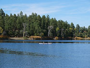
Lynx Lake is a serene 55-acre reservoir at 5,600 feet in the Bradshaw Mountains of the Prescott National Forest — one of central Arizona's most popular recreation areas offering trout fishing, kayaking, hiking, gold panning on Lynx Creek, dispersed camping along FR 30, and a rich mining history stretching back to the first gold discovery in 1863.

